1
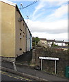
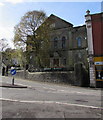
Row of houses on the north side of Pleasant Road, Penygraig
The sign shows 7-11 PLEASANT ROAD.
Image: © Jaggery
Taken: 20 Oct 2017
0.01 miles
2
Pleasant Road, Penygraig
Pleasant Road ascends from Penygraig Road. Penygraig Convenience Store http://www.geograph.org.uk/photo/5575945 is on the left.
Image: © Jaggery
Taken: 20 Oct 2017
0.02 miles
3
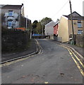
Up Pleasant Road, Penygraig
From the B4278, Pleasant Road ascends towards Gethin Road.
Double yellow lines on both sides of the road indicate no parking at any time.
Image: © Jaggery
Taken: 20 Oct 2017
0.02 miles
4
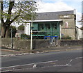
Soar Centre, Penygraig
Formerly Soar Welsh Baptist Chapel.
https://www.coflein.gov.uk/en/site/10289/details/soar-welsh-baptist-chapel-soar-ffrwyd-soar-dinas-penygraig-road-penygraig
Image: © Alan Hughes
Taken: 11 Apr 2019
0.04 miles
5
Penygraig Convenience Store, Penygraig
Premier store at 104 Penygraig Road on the corner of Pleasant Road.
Image: © Jaggery
Taken: 20 Oct 2017
0.04 miles
6
Directions sign, Penygraig Road, Penygraig
Facing southbound traffic on the B4278 Penygraig Road on the approach to a roundabout.
Image: © Jaggery
Taken: 20 Oct 2017
0.04 miles
7
South side of the Soar Centre, Penygraig
In the converted former Soar Chapel. Depictions of two penny-farthing bicycles https://www.geograph.org.uk/photo/6109412 are between the walls. The wide variety of activities in the Soar Centre include coffee mornings, community bingo, positive parenting and counselling sessions. From 4pm on school days, many under 8s use the After School Club.
Image: © Jaggery
Taken: 20 Oct 2017
0.04 miles
8
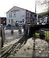
Penny-farthing depictions, Penygraig
Located here https://www.geograph.org.uk/photo/6109411 at the edge of the Soar Centre. The penny-farthing, also known as the ordinary, was the first machine to be called a bicycle. It was popular in the 1870s and 1880s. It became obsolete in the late 1880s with the development of modern bicycles.
Image: © Jaggery
Taken: 20 Oct 2017
0.04 miles
9
Penygraig Labour Club, 11 Penygraig Road, Penygraig
The plaque http://www.geograph.org.uk/photo/5575979 on the wall above the main entrance shows
"LABOUR PROGRESSIVE CLUB EST'D 1904 REBUILT 1912" (EST'D = ESTABLISHED).
Image: © Jaggery
Taken: 20 Oct 2017
0.04 miles
10
East side of the former Soar Baptist Chapel, Penygraig
This is the 1902 rebuild of Soar Baptist Chapel dating from 1832.
The chapel closed in 1978. In 2017 the building is in secular use as the Soar Centre.
Image: © Jaggery
Taken: 20 Oct 2017
0.04 miles


