East side of the former Soar Baptist Chapel, Penygraig
Introduction
The photograph on this page of East side of the former Soar Baptist Chapel, Penygraig by Jaggery as part of the Geograph project.
The Geograph project started in 2005 with the aim of publishing, organising and preserving representative images for every square kilometre of Great Britain, Ireland and the Isle of Man.

There are currently over 7.5m images from over 14,400 individuals and you can help contribute to the project by visiting https://www.geograph.org.uk
East side of the former Soar Baptist Chapel, Penygraig
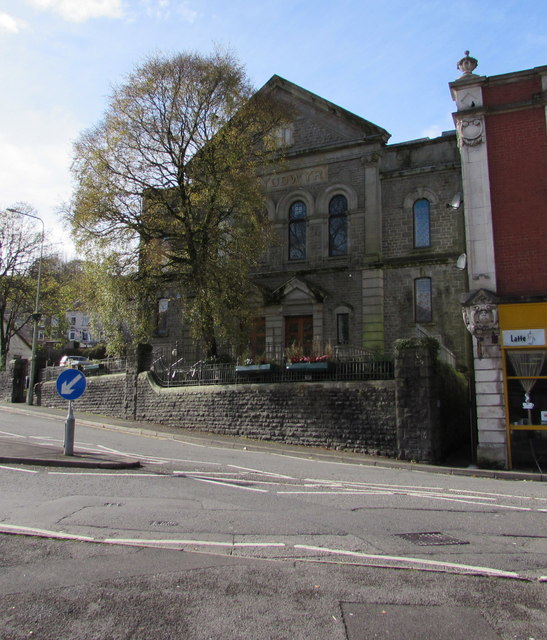
Image: © Jaggery Taken: 20 Oct 2017
This is the 1902 rebuild of Soar Baptist Chapel dating from 1832. The chapel closed in 1978. In 2017 the building is in secular use as the Soar Centre.
Images are licensed for reuse under creativecommons.org/licenses/by-sa/2.0
Image Location
Latitude
51.613392
Longitude
-3.447655