1
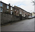
Urinal, De Winton Street, Tonypandy
Located at the southern end of De Winton Street, near the Gilfach Road junction.
Basic urinals, with no other facilities (no pedestal or wash basin) remain in many parts of the Rhondda, whereas they are no longer to be seen in cities such as Cardiff and Newport. They have the advantage (for males only of course!) of being always available.
Image: © Jaggery
Taken: 28 Oct 2011
0.01 miles
2
Former town hall, Tonypandy
Built in 1892, the old town hall is located at the southern end of De Winton Street, near the Gilfach Road junction. The building is currently (late October 2011) for sale. A sign remaining on the building shows that it was previously used as a snooker hall.
Image: © Jaggery
Taken: 28 Oct 2011
0.01 miles
3
Former Tonypandy town hall viewed from Gilfach Road
A view of the rear of the former town hall. The frontage http://www.geograph.org.uk/photo/2674206 is on De Winton Street.
Image: © Jaggery
Taken: 28 Oct 2011
0.01 miles
4
Side view of the former town hall, Tonypandy
Viewed along De Winton Street. Built in 1892, the old town hall building is currently (late October 2011) for sale. A sign on the corner of the building shows that it was previously used as a snooker hall.
Image: © Jaggery
Taken: 28 Oct 2011
0.01 miles
5
Southern end of De Winton Street, Tonypandy
The stone buildings are opposite the former town hall. http://www.geograph.org.uk/photo/2674217 A sign on the wall near the left edge of the buildings shows S B Rawlings The Barber Shop, but the premises did not appear to be open ( mid-morning on a Friday).
The Stagecoach bus is on route 120 from Blaencwm to Caerphilly via Pontypridd.
Image: © Jaggery
Taken: 28 Oct 2011
0.01 miles
6
Unique Shabby Chic, Tonypandy
The De Winton Street shop opened here in June 2011. Unique Shabby Chic's website describes the items on sale as a "mixture of revamped and refurbished quality items of furniture and decorative pieces in a gorgeous shabby chic style."
Image: © Jaggery
Taken: 28 Oct 2011
0.01 miles
7
Gilfach Road houses, Tonypandy
Between the Brynhyfryd junction and the Primrose Street junction.
Image: © Jaggery
Taken: 21 Sep 2017
0.01 miles
8
Ordnance Survey Cut Mark
This damaged OS cut mark can be found on the wall of No36 Gilfach Road.. It marks a point 143.832m above mean sea level.
Image: © Adrian Dust
Taken: 13 May 2017
0.03 miles
9
Up Gilfach Road, Tonypandy
Gilfach Road ascends away from De Winton Street and Dunraven Street.
Image: © Jaggery
Taken: 21 Sep 2017
0.04 miles
10
Nant Clydach just as it disappears under a car park, Tonypandy
Image: © Ruth Sharville
Taken: 24 Aug 2010
0.04 miles


