Former town hall, Tonypandy
Introduction
The photograph on this page of Former town hall, Tonypandy by Jaggery as part of the Geograph project.
The Geograph project started in 2005 with the aim of publishing, organising and preserving representative images for every square kilometre of Great Britain, Ireland and the Isle of Man.

There are currently over 7.5m images from over 14,400 individuals and you can help contribute to the project by visiting https://www.geograph.org.uk
Former town hall, Tonypandy
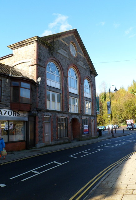
Image: © Jaggery Taken: 28 Oct 2011
Built in 1892, the old town hall is located at the southern end of De Winton Street, near the Gilfach Road junction. The building is currently (late October 2011) for sale. A sign remaining on the building shows that it was previously used as a snooker hall.
Images are licensed for reuse under creativecommons.org/licenses/by-sa/2.0
Image Location
Latitude
51.623161
Longitude
-3.457501