1
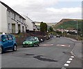
Houses - with views - Rhiw-garn
Staggering views over Porth and the Valleys from this estate. I have submitted an example.
Image: © Ruth Sharville
Taken: 23 Jun 2007
0.01 miles
2
Speed bumps on Rhiwgarn, Trebanog
Painted white triangles draw attention to bumps on the road surface. Sometimes referred to as sleeping policemen, the bumps are intended to coax drivers to slow down to pass over them.
Image: © Jaggery
Taken: 30 Jul 2014
0.03 miles
3
Row of houses in Rhiwgarn, Trebanog
The dark green edge of an electricity substation http://www.geograph.org.uk/photo/4096721 is on the right. The houses are near the eastern edge of housing in Rhiwgarn, located east of the main road through Trebanog. The elevation here is about 260 metres (c 850ft) above sea level. Fine views can be had from many locations hereabouts.
Image: © Jaggery
Taken: 30 Jul 2014
0.04 miles
4
Glawty electricity substation, Rhiwgarn, Trebanog
The identifier on the Western Power Distribution electricity substation is GLAWTY S/S No. 54-2283.
Image: © Jaggery
Taken: 30 Jul 2014
0.05 miles
5
Valley view from Rhiwgarn, Trebanog
Trees partly block a view of Cymmer and Porth.
Image: © Jaggery
Taken: 30 Jul 2014
0.05 miles
6
Upland view from Rhiwgarn, Trebanog
Viewed from near these http://www.geograph.org.uk/photo/4096851 houses.
Image: © Jaggery
Taken: 30 Jul 2014
0.05 miles
7
Houses at the eastern edge of Rhiwgarn, Trebanog
The road on the left leads to a gate and kissing gate at the edge of a track through uplands towards Rhiwgarn Fach Farm.
Image: © Jaggery
Taken: 30 Jul 2014
0.07 miles
8
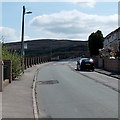
Bus stop in Rhiwgarn, Trebanog
There is a bus stop sign on the lamp post. Rhiwgarn has a frequent bus service:
this road is on bus route 150 from Porth to Gilfach Goch and Gilfach Goch to Porth.
Image: © Jaggery
Taken: 30 Jul 2014
0.08 miles
9
3-storey blocks of flats in Rhiwgarn, Trebanog
The flats are near Waunwen Community Recreation Centre.
Image: © Jaggery
Taken: 30 Jul 2014
0.10 miles
10
View across to Trebanog and Mynydd y Cymmer
Image: © Gareth James
Taken: 2 Jan 2015
0.11 miles


