1
Trebanog Service Station
Viewed across the A4233 Trebanog Road.
Image: © Jaggery
Taken: 30 Jul 2014
0.04 miles
2
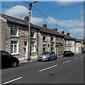
Trebanog Road houses, Trebanog
On the west side of the A4233 Trebanog Road.
Image: © Jaggery
Taken: 30 Jul 2014
0.05 miles
3
Rhondda Tackle, Trebanog
Fishing gear & tackle shop in single-storey premises at 191C Trebanog Road.
Image: © Jaggery
Taken: 16 Nov 2017
0.05 miles
4
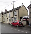
Trebanog Surgery
In late July 2014, a sign on the wall of 191 Trebanog Road shows TREBANOG SURGERY.
The building appears disused.
Image: © Jaggery
Taken: 30 Jul 2014
0.05 miles
5
Carmel Congregational Church, Trebanog
Image: © John Lord
Taken: 1 Nov 2017
0.06 miles
6
Tin chapel in Trebanog
Viewed across the A4233 Trebanog Road. Corrugated metal places of worship are sometimes referred to as tin chapels, though this one is corrugated iron. Many similar chapels have been replaced, but this 1881 example has survived into 2014 (viewed in late July). The name board shows Carmel English Congregational Church. The 'English' part of the name states the language of worship, to distinguish the church from those where Welsh is (or was) used. The bottom line of the nameboard shows
REMEMBERING MOUNT ZION ENGLISH BAPTIST CHURCH 1923-2009.
Mount Zion was a similar tin chapel further south along Trebanog Road. It appears in a Google Earth Street View taken in June 2011, but had been demolished and replaced by a house http://www.geograph.org.uk/photo/4098908 at the late July 2014 date of this view.
Image: © Jaggery
Taken: 30 Jul 2014
0.07 miles
7
Low gear ahead for 1? miles, Trebanog
The sign shows a long and steep (16% or about 1 in 6) descent along the A4233 from Trebanog to Porth.
Image: © Jaggery
Taken: 30 Jul 2014
0.08 miles
8
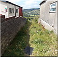
Grassy track to a kissing gate in Trebanog
The 20 metre long track extends from the pavement on the west side of the A4233 Trebanog Road to a kissing gate http://www.geograph.org.uk/photo/4097729 ahead. The edge of Carmel English Congregational Church http://www.geograph.org.uk/photo/4097700 is on the left.
Image: © Jaggery
Taken: 30 Jul 2014
0.08 miles
9
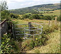
Kissing gate across a public footpath in Trebanog
On the west side of the A4233 Trebanog Road.
The perimeter wall of Carmel English Congregational Church http://www.geograph.org.uk/photo/4097700 is on the left.
Image: © Jaggery
Taken: 30 Jul 2014
0.08 miles
10
Two large storage tanks in Trebanog
Located in a field 100 metres east of the A4233 Trebanog Road. Each tank is about 30 metres (nearly 100 feet) across. I think they are used for water storage. Despite appearances, I doubt whether they are actually Martian flying saucers...
Image: © Jaggery
Taken: 30 Jul 2014
0.08 miles


