1
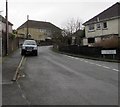
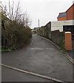
Trem-y-Glyn towards Pen Darren, Trebanog
The road named Trem-y-Glyn leads to the dead-end road named Pen Darren out of shot around the bend.
Image: © Jaggery
Taken: 16 Nov 2017
0.05 miles
2
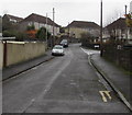
Trem-y-Glyn towards Pen Darren, Trebanog
From Brocks Terrace, the street named Trem-y-Glyn ascends towards Pen Darren.
The right turn is into Olive Terrace. http://www.geograph.org.uk/photo/5602044
Image: © Jaggery
Taken: 16 Nov 2017
0.06 miles
3
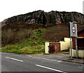
Cliff above Edmondstown Road, Trebanog
Near the western edge of Trebanog.
Image: © Jaggery
Taken: 16 Nov 2017
0.07 miles
4
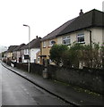
Olive Terrace semis, Trebanog
Semi-detached houses on the north side of Olive Terrace.
Image: © Jaggery
Taken: 16 Nov 2017
0.07 miles
5
Brocks Terrace houses and bus stop, Trebanog
This stop for buses to Tonyrefail, Talbot Green, Cardiff etc.
Image: © Jaggery
Taken: 16 Nov 2017
0.09 miles
6
Enjoying the view
The view from just below Lincolns rock looking down the valley south easterly
Image: © David Locke
Taken: 19 May 2009
0.09 miles
7
Back lane in Trebanog
On the east side of the corner of Brocks Terrace and Trem-y-Glyn.
Image: © Jaggery
Taken: 16 Nov 2017
0.09 miles
8
Row of houses at the western edge of Trebanog
The Trebanog boundary sign is on the left.
Image: © Jaggery
Taken: 16 Nov 2017
0.09 miles
9
Edmondstown Road towards Trebanog
The road from Edmondstown approaches the western edge of Trebanog.
Image: © Jaggery
Taken: 16 Nov 2017
0.09 miles
10
End of the 30 zone at the western edge of Trebanog
The 30mph speed limit on Edmondstown Road in Trebanog increases to 40mph.
The eastern edge of Edmondstown is in the distance.
Image: © Jaggery
Taken: 16 Nov 2017
0.09 miles


