1
Ordnance Survey Cut Mark
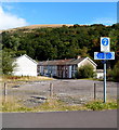
This OS cut mark can be found on No28 Dan Y Graig Terrace. It marks a point 131.686m above mean sea level.
Image: © Adrian Dust
Taken: 24 Jun 2017
0.02 miles
2
A4233 heads ESE away from Wattstown
Built in 2005, the A4233 is the Porth and Lower Rhondda Fach Relief Road (Porth Bypass),
which follows the route of a dismantled railway line.
Image: © Jaggery
Taken: 19 Sep 2012
0.02 miles
3
Wattstown Rugby Club
Taken from the footbridge over the new road
Image: © John Lord
Taken: 6 Sep 2008
0.05 miles
4
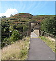
NE side of a footbridge over the A4233, Ynyshir
Viewed from the Rhondda Fach Trail looking across the A4233 towards Ynyshir Road.
Built in 2005, the A4233 is the Porth and Lower Rhondda Fach Relief Road (Porth Bypass),
which follows the route of a dismantled railway line.
Image: © Jaggery
Taken: 19 Sep 2012
0.06 miles
5
Girder bridge
Bridge over the A4233 between Ynyshir and Wattstown.
Image: © Alan Hughes
Taken: 23 May 2019
0.06 miles
6
Wattstown roundabout on the A4233
Image: © Colin Pyle
Taken: 4 Jan 2010
0.07 miles
7
Footbridge over the A4233, Ynyshir
Viewed from the Ynyshir Road side. Built in 2005, the A4233 is the Porth and Lower Rhondda Fach Relief Road (Porth Bypass), which follows the route of the dismantled Rhondda Fach branch railway line.
Image: © Jaggery
Taken: 19 Sep 2012
0.07 miles
8
Roadside bank protection, Ynyshir Road near Wattstown
Metal meshing bolted into the hillside gives a degree of stability to the slope.
Image: © Jaggery
Taken: 19 Sep 2012
0.09 miles
9
Ynyshir Road side of an extensive footbridge, Ynyshir
The footbridge crosses the A4233.
Image: © Jaggery
Taken: 19 Sep 2012
0.09 miles
10
Rhondda Fach Trail and Lower Bailey Street, Wattstown
One sign arm alongside the Rhondda Fach Trail points left towards Maerdy, Tylorstown and Wattstown (west). The arm pointing right shows Porth, Ynyshir and Wattstown (east).
Lower Bailey Street Wattstown is in the background
Image: © Jaggery
Taken: 19 Sep 2012
0.10 miles


