1
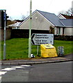
Trem y Cwm
Trem-Y-Cwm in Beddau is largely sheltered housing provided by the local council.
Image: © Derek Cummings
Taken: 10 Feb 2010
0.09 miles
2
Gwaunmiskin Road
This is a long road passing through the heart of Beddau.
Image: © Derek Cummings
Taken: 10 Feb 2010
0.13 miles
3
Beddau Church
Image: © Duncan and Gareth Alderson
Taken: 8 Jun 2008
0.14 miles
4
Start of the 20 zone, Common Approach, Beddau
The 30mph speed limit on Common Approach drops to 20mph near a speed bump.
Pointing this way, a nearby sign https://www.geograph.org.uk/photo/5722400 shows half a mile to Gwaunmiskin, 3 miles to Talbot Green.
Viewed from the corner of Tynant Road.
Image: © Jaggery
Taken: 30 Mar 2018
0.15 miles
5
Not Quite a Village Green
A green space, but not quite a village green, at the edge of housing on Llwyncrwn Road in Beddau.
Image: © Alan Hughes
Taken: 9 Mar 2017
0.15 miles
6
Yellow grit/salt box on a Beddau corner
On the corner of Llwyncrwn Road and Common Approach, half a mile from Gwaunmiskin,
3 miles from Talbot Green. The Welsh names of the two locations are also shown.
Image: © Jaggery
Taken: 30 Mar 2018
0.15 miles
7
Signs at the eastern end of Llwyncrwn Road, Beddau
No motor vehicles except for access and No Through Road. Llwyncrwn Road is not
a through route because of this https://www.geograph.org.uk/photo/5722099 metal barrier across the road 150 metres ahead.
Image: © Jaggery
Taken: 30 Mar 2018
0.16 miles
8
St.Michael's Church
Church of St.Michael and All Angels, Beddau.
Image: © Alan Hughes
Taken: 9 Mar 2017
0.16 miles
9
Mini-roundabout at crossroads in Beddau
Llwyncrwn Road is on the left and the B4595 Gwaunmiskin Road on the right,
where a direction sign shows Penycoedcae 2¾ (miles), Tonyrefail 3.
Image: © Jaggery
Taken: 30 Mar 2018
0.16 miles
10
West side of Grade II (star) listed Church of St Michael and All Angels, Beddau
The church is in the Church in Wales Parish of Llantrisant in the Diocese of Llandaff.
See https://www.geograph.org.uk/photo/5722140 for another view and some details.
Image: © Jaggery
Taken: 30 Mar 2018
0.16 miles


