1
Benchmark cut on bridge support near Tynant
Easy to locate cut on the bridge support (south support, south east corner)
Image: © MayfieldAlpha
Taken: 29 Jun 2024
0.14 miles
2
Former railway bridge in Tynant
Image: © Gareth James
Taken: 4 Jun 2011
0.14 miles
3
Rivet Benchmark on footpath step near Croesged
Rivet benchmark found located on a step on the footpath near Croesged. Mostly covered with dirt; you can just make out the mark.
Image: © MayfieldAlpha
Taken: 29 Jun 2024
0.15 miles
4
B4595 Woodlands
Image: © Colin Pyle
Taken: 21 Apr 2018
0.16 miles
5
Tynant Garage, Tynant
Set back from the south side of the B4595 Woodlands.
Image: © Jaggery
Taken: 7 Apr 2018
0.17 miles
6
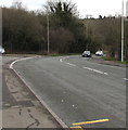
Towards a bend in the B4595, Tynant
Maps shows that the road is the B4595 Parish Road near
the camera and the B4595 Woodlands beyond the junction.
Image: © Jaggery
Taken: 7 Apr 2018
0.21 miles
7
Yellow sign facing the B4595 Woodlands in Tynant near Beddau
The sign shows that Bob Gay Plant Hire Ltd are sponsors to Beddau R.F.C. (Rugby Football Club).
The next home game features the second team at 2:30 on Saturday.
Image: © Jaggery
Taken: 7 Apr 2018
0.21 miles
8
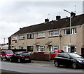
On-street parking, Fairview, Tynant
Cars are parked alongside a row of houses in Fairview, a road on the south side of the B4595.
Image: © Jaggery
Taken: 7 Apr 2018
0.23 miles
9
Road towards the former Cwm Coking Works, Tynant
From the north side of the B4595 towards the site of Cwm Coking Works which closed in 2002.
Faded in April 2018, the sign on the right showing CPL Cwm Coking Works remains in place.
The sign on the left shows RESPECT OUR NEIGHBOURS - PLEASE DRIVE SLOWLY.
Image: © Jaggery
Taken: 7 Apr 2018
0.23 miles
10
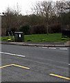
Dark green cabinet alongside the B4595 Parish Road, Tynant
A temporary road sign is alongside the telecoms cabinet in April 2018.
Image: © Jaggery
Taken: 7 Apr 2018
0.23 miles


