IMAGES TAKEN NEAR TO
Foel View Close, PONTYPRIDD, CF38 2PL
Introduction
This page details the photographs taken nearby to Foel View Close, CF38 2PL by members of the Geograph project.
The Geograph project started in 2005 with the aim of publishing, organising and preserving representative images for every square kilometre of Great Britain, Ireland and the Isle of Man.

There are currently over 7.5m images from over14,400 individuals and you can help contribute to the project by visiting https://www.geograph.org.uk
Image Map
Images are licensed for reuse under creativecommons.org/licenses/by-sa/2.0
Notes
- Clicking on the map will re-center to the selected point.
- The higher the marker number, the further away the image location is from the centre of the postcode.
Image Listing (10 Images Found)
Images are licensed for reuse under creativecommons.org/licenses/by-sa/2.0
Image
Details
Distance
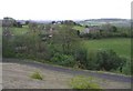
1
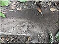
Rivet Benchmark on footpath step near Croesged
Rivet benchmark found located on a step on the footpath near Croesged. Mostly covered with dirt; you can just make out the mark.
Image: © MayfieldAlpha
Taken: 29 Jun 2024
0.07 miles
2
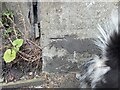
Benchmark cut on bridge support near Tynant
Easy to locate cut on the bridge support (south support, south east corner)
Image: © MayfieldAlpha
Taken: 29 Jun 2024
0.19 miles
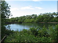
5
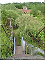
View from the footbridge, near Cwm Coke Works
Image: © Gareth James
Taken: 4 Jun 2011
0.21 miles
6

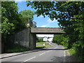
Tynant Garage, Tynant
Set back from the south side of the B4595 Woodlands.
Image: © Jaggery
Taken: 7 Apr 2018
0.22 miles
8
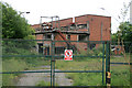
Cwm Coke - probable booster house
Based on the activities of the urban explorers I believe this is the booster house with reciprocating compressors delivering the gas to the holders and distribution system. Image is a similar building at the defunct Orgreave Coke Works. The exhauster house is presumably back closer to the battery but from the urban explorer sites I suspect it has been stripped. Image shows an exhauster house in the CPL plant at Hawthorn.
Image: © Chris Allen
Taken: 8 Jun 2009
0.24 miles
9
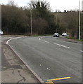
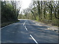
Towards a bend in the B4595, Tynant
Maps shows that the road is the B4595 Parish Road near
the camera and the B4595 Woodlands beyond the junction.
Image: © Jaggery
Taken: 7 Apr 2018
0.24 miles