1
The Welsh Shop, Gwaelod-y-garth Road, Upper Boat
The Welsh Shop is on the right, City Plumbing is on the left.
Image: © Jaggery
Taken: 13 Feb 2014
0.18 miles
2
Greggs, Taffs Fall Road, Upper Boat
Located at the edge of the Treforest Industrial Estate, which is not
a geographically accurate name, as Treforest is about 3km to the NW.
Image: © Jaggery
Taken: 13 Feb 2014
0.21 miles
3
Griffin Mill Garages in Upper Boat
New and used car dealers business viewed across Tonteg Road
Image: © Jaggery
Taken: 13 Feb 2014
0.21 miles
4
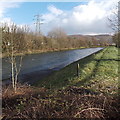
Riverbank track, Upper Boat
The track alongside the River Taff heads SE away from this road bridge. http://www.geograph.org.uk/photo/3847556
Image: © Jaggery
Taken: 13 Feb 2014
0.22 miles
5
Car Showroom, Tonteg Road
Free advertising ? I should charge Vauxhall for this photographic promotion !
Image: © Kev Griffin
Taken: 25 Apr 2007
0.22 miles
6
West side of the River Taff bridge, Upper Boat
The Taff is about 30 metres wide here. Viewed in mid-February during the very wet winter of 2013-2014. Though fast flowing today, the Taff in this area has not burst its banks. The water level is far below the bottom of the gauge (centre left).
Image: © Jaggery
Taken: 13 Feb 2014
0.23 miles
7
Railway lines NW of Treforest Estate railway station
Viewed from the NW edge of Treforest Estate railway station. http://www.geograph.org.uk/photo/2753225 The next station is this direction is Treforest, nearly 4km away.
Image: © Jaggery
Taken: 6 Jan 2012
0.23 miles
8
Gwaelod-y-Garth Road Bridge, Treforest Industrial Estate
Image: © Kev Griffin
Taken: 25 Apr 2007
0.23 miles
9
Treforest Industrial Estate
River Taff and the Gwaelod-y-Garth Road Bridge can be seen in the distance.
Image: © Kev Griffin
Taken: 25 Apr 2007
0.24 miles
10
River Taff, Treforest Industrial Estate
Image: © Kev Griffin
Taken: 25 Apr 2007
0.24 miles


