IMAGES TAKEN NEAR TO
Brynderwen Close, PONTYPRIDD, CF37 4EJ

Introduction

This page details the photographs taken nearby to Brynderwen Close, CF37 4EJ by members of the Geograph project.

The Geograph project started in 2005 with the aim of publishing, organising and preserving representative images for every square kilometre of Great Britain, Ireland and the Isle of Man.

There are currently over 7.5m images from over14,400 individuals and you can help contribute to the project by visiting https://www.geograph.org.uk

Image Map


Images are licensed for reuse under creativecommons.org/licenses/by-sa/2.0
Notes
  • Clicking on the map will re-center to the selected point.
  • The higher the marker number, the further away the image location is from the centre of the postcode.

Image Listing (14 Images Found)

Images are licensed for reuse under creativecommons.org/licenses/by-sa/2.0
Image
Details
Distance
1
Cilfynydd Primary School
Image: © Alex McGregor Taken: 25 Jun 2012
0.08 miles
2
Ordnance Survey Cut Mark
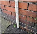
This OS cut mark can be found on No71 Mary Street. It marks a point 98.667m above mean sea level.
Image: © Adrian Dust Taken: 2 May 2024
0.09 miles
3
Cilfynydd from footbridge over the A470
The village of Cilfynydd near Pontypridd. Top left shows the remnants of the colliery spoil tip.
Image: © jeff lewis Taken: 12 Apr 2009
0.09 miles
4
Ordnance Survey Cut Mark
This OS cut mark can be found on No99 Wood Street. It marks a point 114.577m above mean sea level.
Image: © Adrian Dust Taken: 2 May 2024
0.10 miles
5
Taff Vale (Cwm Taf)
View over Cilfynydd towards Pontypridd. Beyond the wooded hillside is the mouth of the Rhondda valley. Afon Rhondda flows into the Taf at Pontypridd.
Image: © Alan Hughes Taken: 26 Aug 2021
0.11 miles
6
The Commercial Hotel, Cilfynydd
Image: © Roger Cornfoot Taken: 14 Mar 2009
0.12 miles
7
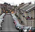
William Street in Cilfynydd
Image: © Gareth James Taken: 30 Jul 2016
0.13 miles
8
Ordnance Survey Cut Mark
This OS cut mark can be found on No1 William Street. It marks a point 86.835m above mean sea level.
Image: © Adrian Dust Taken: 2 May 2024
0.16 miles
9
Bend in Nant Cae-dudwg, Pant-du Road
Looking downstream from a road bridge Image; the purpose of the metal barrier in the river is not clear - perhaps to lessen damage to the bank.
Image: © M J Roscoe Taken: 24 Mar 2018
0.21 miles
10
Cilfynydd Road, Cilfynydd
Image: © Alex McGregor Taken: 31 Jan 2012
0.22 miles