IMAGES TAKEN NEAR TO
Ynysybwl, PONTYPRIDD, CF37 3PD
Introduction
This page details the photographs taken nearby to CF37 3PD by members of the Geograph project.
The Geograph project started in 2005 with the aim of publishing, organising and preserving representative images for every square kilometre of Great Britain, Ireland and the Isle of Man.

There are currently over 7.5m images from over14,400 individuals and you can help contribute to the project by visiting https://www.geograph.org.uk
Image Map
Images are licensed for reuse under creativecommons.org/licenses/by-sa/2.0
Notes
- Clicking on the map will re-center to the selected point.
- The higher the marker number, the further away the image location is from the centre of the postcode.
Image Listing (50 Images Found)
Images are licensed for reuse under creativecommons.org/licenses/by-sa/2.0
Image
Details
Distance
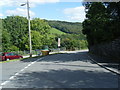
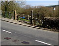
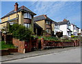
2
Junction of Clydach Road and Rock Terrace, Ynysybwl
Rock Terrace on the left diverges from Clydach Road.
Image: © Jaggery
Taken: 16 Apr 2015
0.02 miles
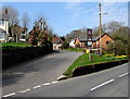
3

Daffodils and a bench in a grass triangle, Ynysybwl
At the junction of Rock Terrace and the B4273 Clydach Road.
Image: © Jaggery
Taken: 16 Apr 2015
0.02 miles
4
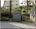
Old Ynysybwl Kiosk
The Western Power Distribution electricity substation is on the south side of the B4273 Old Ynysybwl Road.
Its identifier is OLD YNYSYBWL KIOSK S/S 552117.
Image: © Jaggery
Taken: 16 Apr 2015
0.03 miles
5
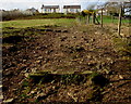
Up a rough track to Clydach Road, Ynysybwl
Ascending towards Clydach Road from the valley of a stream named Y Ffrwd.
Image: © Jaggery
Taken: 16 Apr 2015
0.03 miles
6
Kissing gate to a public footpath from Clydach Road, Ynysybwl
The sign on the right indicates a public footpath. The reality is a steep, rough track. http://www.geograph.org.uk/photo/4438334
Image: © Jaggery
Taken: 16 Apr 2015
0.03 miles
7
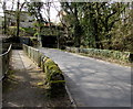
Road bridge and footbridge over Y Ffrwd, Ynysybwl
The B4273 and a pavement cross the bridges over a stream named Y Ffrwd.
Image: © Jaggery
Taken: 16 Apr 2015
0.04 miles
8
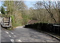
Mill Road, Ynysybwl
Mill Road descends into the valley of a stream, Y Ffrwd.
Viewed from the B4273. This junction is the NW end/start of the B4273.
Image: © Jaggery
Taken: 16 Apr 2015
0.04 miles
9
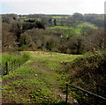
Rough track from Clydach Road to Mill Road, Ynysybwl
Descending towards the valley of a stream named Y Ffrwd.
Image: © Jaggery
Taken: 16 Apr 2015
0.05 miles
10
Houses set above the Glanffrwd Terrace roadway, Ynysybwl
Near the Clydach Road junction. The red postbox http://www.geograph.org.uk/photo/4438243 in the wall
is from the reign of King George VI (December 1936-February 1952).
Image: © Jaggery
Taken: 16 Apr 2015
0.05 miles