1
Houses set above the Glanffrwd Terrace roadway, Ynysybwl
Near the Clydach Road junction. The red postbox http://www.geograph.org.uk/photo/4438243 in the wall
is from the reign of King George VI (December 1936-February 1952).
Image: © Jaggery
Taken: 16 Apr 2015
0.01 miles
2
Kissing gate to a public footpath from Clydach Road, Ynysybwl
The sign on the right indicates a public footpath. The reality is a steep, rough track. http://www.geograph.org.uk/photo/4438334
Image: © Jaggery
Taken: 16 Apr 2015
0.02 miles
3
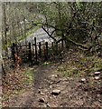
Up a rough track to Clydach Road, Ynysybwl
Ascending towards Clydach Road from the valley of a stream named Y Ffrwd.
Image: © Jaggery
Taken: 16 Apr 2015
0.02 miles
4
King George VI postbox in a Glanffrwd Terrace wall, Ynysybwl
Located on the left here. http://www.geograph.org.uk/photo/4438260
Image: © Jaggery
Taken: 16 Apr 2015
0.02 miles
5
Daffodils and a bench in a grass triangle, Ynysybwl
At the junction of Rock Terrace and the B4273 Clydach Road.
Image: © Jaggery
Taken: 16 Apr 2015
0.03 miles
6
Junction of Clydach Road and Rock Terrace, Ynysybwl
Rock Terrace on the left diverges from Clydach Road.
Image: © Jaggery
Taken: 16 Apr 2015
0.03 miles
7
Rock Terrace/Clydach Road junction
Image: © Colin Pyle
Taken: 31 Aug 2010
0.04 miles
8
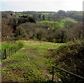
Rough track from Clydach Road to Mill Road, Ynysybwl
Descending towards the valley of a stream named Y Ffrwd.
Image: © Jaggery
Taken: 16 Apr 2015
0.04 miles
9
Kissing gate at the edge of Mill Road, Ynysybwl
Giving access to and from this http://www.geograph.org.uk/photo/4438367 steep rough track.
Image: © Jaggery
Taken: 16 Apr 2015
0.07 miles
10
Old Ynysybwl Kiosk
The Western Power Distribution electricity substation is on the south side of the B4273 Old Ynysybwl Road.
Its identifier is OLD YNYSYBWL KIOSK S/S 552117.
Image: © Jaggery
Taken: 16 Apr 2015
0.07 miles


