1
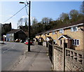
Archer Street, Ynysybwl
The houses at the bottom are on Peygraig Terrace. The hill behind is Pen y Foel, with evidence of the coal tips from the local pit.
Image: © Steve Sheppard
Taken: 28 May 2007
0.02 miles
2
Windsor Cottages, Ynysybwl
Two semi-detached cottages on the west side of the B4273 Windsor Place.
Image: © Jaggery
Taken: 16 Apr 2015
0.05 miles
3
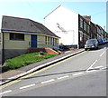
Windsor Court and Windsor Cottages, Ynysybwl
Housing on the west side of the B4273 Windsor Place. Windsor Court is on the right.
Image: © Jaggery
Taken: 16 Apr 2015
0.05 miles
4
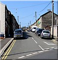
Paget Street, Ynysybwl
Looking westwards across Penygraig Terrace.
Image: © Jaggery
Taken: 16 Apr 2015
0.05 miles
5
Ordnance Survey Cut Mark
This OS cut mark can be found on No16 Clive Terrace. It marks a point 166.570m above mean sea level.
Image: © Adrian Dust
Taken: 1 Mar 2021
0.05 miles
6
Penygraig Terrace houses, Ynysybwl
The car is in Paget Street. http://www.geograph.org.uk/photo/4433191
Image: © Jaggery
Taken: 16 Apr 2015
0.05 miles
7
Ynysybwl Telephone Exchange
British Telecom site set back from the east side of Windsor Place.
Image: © Jaggery
Taken: 16 Apr 2015
0.07 miles
8
Station Yard surgery, Ynysybwl
Medical surgery set back 50 metres from Windsor Place in a former Great Western Railway building.
This is a branch surgery of Taff Vale Practice based in Rhydyfelin, Pontypridd.
There has not been a railway service in the village for many decades.
The last passenger train from Ynysybwl Halt to Pontypridd was in 1953.
Image: © Jaggery
Taken: 16 Apr 2015
0.08 miles
9
Former Ynysybwl police station
Viewed in April 2015. The Police Station name board seen in a September 2009 Google Earth Street View
has gone from the single storey building at the eastern end of Paget Street.
Image: © Jaggery
Taken: 16 Apr 2015
0.08 miles
10
Ynysybwl Community Project hall
Located in the centre of the village, between Windsor Place on the right and Penygraig Terrace.
Image: © Jaggery
Taken: 16 Apr 2015
0.09 miles


