1
Mill Street underpass, Pontypridd
Depicted on the mural nearest the camera are Evan James and his son James James.
Evan James lived where he worked as a weaver, nearby in Mill Street. In 1856 he wrote the words, and James the music, for "Glan Rhondda". It was later renamed Hen Wlad Fy Nhadau, and gained the status of the Welsh National Anthem within three decades. It was also adapted and adopted as the Breton National Anthem in 1902.
Image: © Jaggery
Taken: 12 Jan 2012
0.01 miles
2
Subway Art (2)
Brass Band as part of the subway art in Pontypridd. They all look the same.
Image: © Chris Thomas-Atkin
Taken: 5 Apr 2019
0.01 miles
3
Subway Art (1)
Sir Geraint Evans as part of the subway art in Pontypridd.
Image: © Chris Thomas-Atkin
Taken: 5 Apr 2019
0.02 miles
4
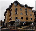
Tŷ Pennant, Pontypridd
The Upper Church Road and Gelliwastad Road corner of Tŷ Pennant,
the head office of community housing business RCT Homes.
Image: © Jaggery
Taken: 25 Nov 2014
0.02 miles
5
Sardis Road, Pontypridd
Taken from land adjacent to Catherine Street Car Park, facing South
Image: © Kev Griffin
Taken: 14 Nov 2004
0.02 miles
6
St Catherine's Church, Pontypridd
Anglican church located on Gelliwastad Grove.
The foundation stone was laid in 1866 and the main body of the church was completed in 1869. Various extensions and renovations have occurred since then, most recently in the early 2000s.
Image: © Jaggery
Taken: 21 Apr 2010
0.02 miles
7
Entrance to Catherine Street multi-storey car park, Pontypridd
From Upper Church Street. Maximum vehicle height shown is 2.1 metres (7' 0").
Image: © Jaggery
Taken: 25 Nov 2014
0.02 miles
8
Upper Church Street, Pontypridd
A dead-end street on the west side of Gelliwastad Road.
Tŷ Pennant http://www.geograph.org.uk/photo/4260730 is on the left.
Image: © Jaggery
Taken: 25 Nov 2014
0.03 miles
9
Catherine Street Car Park, Pontypridd
Image: © Kev Griffin
Taken: 14 Nov 2004
0.03 miles
10
Ordnance Survey Cut Mark
This very worn OS cut mark can be found on No10 Mill Street. It marks a point 56.574m above mean sea level.
Image: © Adrian Dust
Taken: 23 Jun 2018
0.03 miles


