1
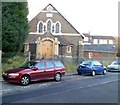
Treforest Primary School plaque, Pontypridd
The plaque is on a wall here. http://www.geograph.org.uk/photo/3395976
Image: © Jaggery
Taken: 12 Jan 2012
0.02 miles
2
Ruler Way, Treforest, Pontypridd
Viewed from Princess Street. Ruler Way is a street of recently-built houses on the site
formerly occupied by Treforest Primary School for more than a century. http://www.geograph.org.uk/photo/3395980
Image: © Jaggery
Taken: 12 Jan 2012
0.02 miles
3
The Red Lounge, Treforest
Restaurant and theme bar at 71 Wood Road.
The premises were formerly occupied by Tom's Entertainment Venue.
Image: © Jaggery
Taken: 9 Dec 2011
0.04 miles
4
Tesco Express, Treforest
Recently-built premises located in Broadway Retail Park, set back from the north side of Broadway, Treforest. Opening times displayed on the building are 6am to 11pm (seven days a week).
Image: © Jaggery
Taken: 9 Dec 2011
0.04 miles
5
The Railway Inn, Treforest
Formerly The Golden Age, located on the corner of Broadway and Cambrian Place.
Image: © Jaggery
Taken: 9 Dec 2011
0.04 miles
6
Princess Street, Treforest, Pontypridd
This is the NW end of Princess Street, viewed across Stow Hill.
Image: © Jaggery
Taken: 12 Jan 2012
0.04 miles
7
Park Presbyterian Church, Treforest
Located on Princess Street, near the Y-junction with Queen Street and New Park Crescent.
The year stone shows 1909.
Image: © Jaggery
Taken: 9 Dec 2011
0.05 miles
8
Former Forest pub, Treforest
Large derelict building on the corner of New Park Crescent and Wood Road.
The name on the building is The Forest. It was also known as The Forest Hotel and The Cot.
Image: © Jaggery
Taken: 9 Dec 2011
0.06 miles
9
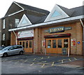
Barinis, Treforest
Lounge, cafe bar and restaurant located in Broadway Retail Park on the north side of Broadway, Treforest, next door to a Tesco Express. http://www.geograph.org.uk/photo/2756473
Image: © Jaggery
Taken: 9 Dec 2011
0.06 miles
10
Kingsland Terrace, Treforest
Looking north from Duke Street.
Image: © Jaggery
Taken: 30 Jan 2014
0.06 miles


