1
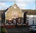
St Michael's Court, Pontypridd
Flats on the north side of Wood Road, occupying part of the site of the demolished St Michael's School.
Image: © Jaggery
Taken: 12 Jan 2012
0.01 miles
2
Ordnance Survey Cut Mark
This OS cut mark can be found at the junction of Wood Road & Cliff Terrace. It marks a point 85.341m above mean sea level.
Image: © Adrian Dust
Taken: 23 Jun 2018
0.01 miles
3
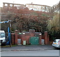
House formerly part of St Michael's School, Pontypridd
The house, on the north side of Wood Road, was formerly part of the otherwise demolished St Michael's Catholic School. There is an inscription of three lines on a tablet on the wall between the two rows of windows. The first line has been obliterated. The second and third lines are GRAMMAR SCHOOL and 1875. This cannot refer to St Michael's, which was not a grammar school and did not occupy this site until 1883. The house was for a time the residence of the school caretaker.
Image: © Jaggery
Taken: 12 Jan 2012
0.02 miles
4
Former Pontypridd Synagogue
The former synagogue at the NW end of Cliff Terrace is now in residential use.
Image: © Jaggery
Taken: 12 Jan 2012
0.02 miles
5
Ramp from Cliff Terrace to Wood Road, Pontypridd
Viewed from near the former Pontypridd Synagogue. http://www.geograph.org.uk/photo/3208830
Image: © Jaggery
Taken: 12 Jan 2012
0.02 miles
6
Broadway urinal, Treforest
Basic facility for males (no pedestals or wash basin) located next to Broadway Van Centre. http://www.geograph.org.uk/photo/2756692
The hilltop houses are on Cliff Terrace.
Image: © Jaggery
Taken: 9 Dec 2011
0.03 miles
7
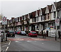
Wood Road, Pontypridd
The western end of Wood Road viewed from the eastern end of Rickards Street.
Image: © Jaggery
Taken: 12 Jan 2012
0.04 miles
8
From 20 to 30, Broadway, Treforest
The 20mph speed limit on the A473 Broadway increases to 30mph.
Image: © Jaggery
Taken: 8 Mar 2019
0.05 miles
9
Two shops on the corner of Tower Street and Laura Street, Pontypridd
The shop on the right, with a TO LET board on the door, was formerly the premises of Crafty Changes,
a craft shop. The shop on the left shows the name Hazel's. The windows are shuttered (early Thursday afternoon) and a board showing a phone number is badly faded. Formerly a hairdressers, perhaps?
Image: © Jaggery
Taken: 12 Jan 2012
0.06 miles
10
Army Reserve Centre direction sign, Broadway, Treforest
Pointing towards Alexandra Road https://www.geograph.org.uk/photo/6082598 the sign shows that
Army Reserve Centre is Canolfan Milwyr wrth Gefn y Fyddin in Welsh.
Image: © Jaggery
Taken: 8 Mar 2019
0.06 miles


