House formerly part of St Michael's School, Pontypridd
Introduction
The photograph on this page of House formerly part of St Michael's School, Pontypridd by Jaggery as part of the Geograph project.
The Geograph project started in 2005 with the aim of publishing, organising and preserving representative images for every square kilometre of Great Britain, Ireland and the Isle of Man.

There are currently over 7.5m images from over 14,400 individuals and you can help contribute to the project by visiting https://www.geograph.org.uk
House formerly part of St Michael's School, Pontypridd
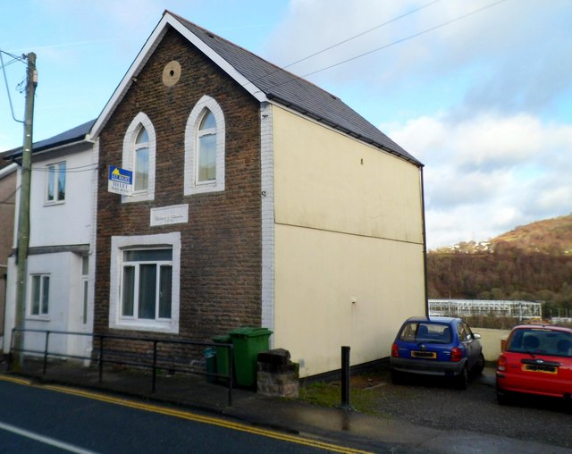
Image: © Jaggery Taken: 12 Jan 2012
The house, on the north side of Wood Road, was formerly part of the otherwise demolished St Michael's Catholic School. There is an inscription of three lines on a tablet on the wall between the two rows of windows. The first line has been obliterated. The second and third lines are GRAMMAR SCHOOL and 1875. This cannot refer to St Michael's, which was not a grammar school and did not occupy this site until 1883. The house was for a time the residence of the school caretaker.
Images are licensed for reuse under creativecommons.org/licenses/by-sa/2.0
Image Location
Latitude
51.59757
Longitude
-3.333525