1
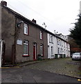
Fernbank House, Pontypridd
Looking along Union Street towards Fernbank House, which contains 32 1-bedroom flats, built in 1987. There is a resident management staff and community alarm service.
Image: © Jaggery
Taken: 9 Dec 2011
0.01 miles
2
Taipren, Graig, Pontypridd
Six semi-detached houses on the south side of Rickards Street.
Image: © Jaggery
Taken: 19 Nov 2014
0.01 miles
3
Rickards Terrace, Graig, Pontypridd
Short dead-end street viewed from Madoc Street. Below the street name sign, a notice shows
PRIVATE ROAD. NO PARKING. NO TURNING. WHEEL CLAMPS IN USE.
Image: © Jaggery
Taken: 19 Nov 2014
0.01 miles
4
Wind of the Valley, Graig, Pontypridd
Chinese takeaway at 36B High Street.
Image: © Jaggery
Taken: 19 Nov 2014
0.02 miles
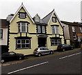
5
Houses and former chapel, Rickard St, Gaig
Image: © John Lord
Taken: 28 Oct 2017
0.02 miles
6
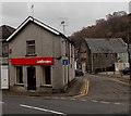
Ladbrokes, Graig, Pontypridd
Betting shop on the corner of High Street and Taipren.
Image: © Jaggery
Taken: 19 Nov 2014
0.02 miles
7
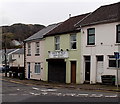
Victoria Inn, Pontypridd
Viewed across High Street, Graig, Pontypridd. This pub looks to be unnamed,
but names are in view (though not very visible) - on the ground floor windows.
Image: © Jaggery
Taken: 19 Nov 2014
0.03 miles
8
Former pub in High Street, Graig, Pontypridd
The name signs seen here http://www.geograph.org.uk/photo/2757831 in December 2011 have gone in this view taken in November 2014. Formerly the Maritime Arms, earlier The Globe.
Image: © Jaggery
Taken: 19 Nov 2014
0.03 miles
9
Path from Graig Street to Graig Terrace and Madoc Street, Graig, Pontypridd
From the eastern end of Graig Street.
Image: © Jaggery
Taken: 19 Nov 2014
0.03 miles
10
West along Graig Street, Graig, Pontypridd
From the eastern end of the street.
Image: © Jaggery
Taken: 19 Nov 2014
0.04 miles


