1
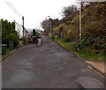
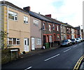
Towards the eastern end of Graig Terrace, Graig, Pontypridd
Not a through route.
Image: © Jaggery
Taken: 19 Nov 2014
0.01 miles
2
44 Rickards Street, Pontypridd
3 storeys high, 44 Rickards Street is conspicuously unlike neighbouring properties.
Now in residential use, it was probably once a shop or pub.
Image: © Jaggery
Taken: 12 Jan 2012
0.03 miles
3
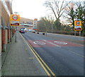
SE boundary of Pontypridd Town
Broadway reaches the boundary of Pontypridd Town, part of the Pontypridd community in Rhondda Cynon Taf, Wales. The 2001 UK Census recorded the population of Pontypridd community as 29,781 of which Pontypridd Town contributed 2,919 inhabitants.
Pontypridd is often referred to locally as "Ponty".
Image: © Jaggery
Taken: 9 Dec 2011
0.06 miles
4
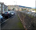
Railway perimeter wall, Rickards Street, Pontypridd
The long wall on the north side of Rickards Street is at the edge of (and several metres above)
railway lines east of Pontypridd railway station.
Image: © Jaggery
Taken: 12 Jan 2012
0.06 miles
5
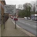
For Rhondda Valleys Use Both Lanes, Pontypridd
The sign faces westbound traffic on the A4058. The text is also in Welsh.
Image: © Jaggery
Taken: 8 Mar 2019
0.06 miles
6
End of the dual carriageway, Broadway, Pontypridd
Two-way traffic signs are alongside the A4058 here named Broadway.
The high wall is at the edge of the railway on the approach to Pontypridd railway station.
Image: © Jaggery
Taken: 8 Mar 2019
0.07 miles
7
Mitchells Terrace, Pontypridd
Mitchells Terrace is a separately-named row of houses on the north side of Rickards Street.
Image: © Jaggery
Taken: 12 Jan 2012
0.07 miles
8
View south at Pontypridd station
Image: © Peter Whatley
Taken: 30 May 2022
0.08 miles
9
Relief sculpture, wall between road and railway, Pontypridd
Image: © David Smith
Taken: 21 Sep 2022
0.08 miles
10
Laura Street, Pontypridd
Laura Street climbs away from Tower Street.
Image: © Jaggery
Taken: 12 Jan 2012
0.08 miles


