1
Ordnance Survey Cut Mark
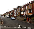
This OS cut mark can be found on the wall of No3 Lanelay Crescent. It marks a point 81.068m above mean sea level.
Image: © Adrian Dust
Taken: 23 Jun 2018
0.01 miles
2
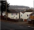
NW end of Lanelay Terrace, Pontypridd
Viewed from Lanelay Crescent.
Image: © Jaggery
Taken: 19 Nov 2014
0.03 miles
3
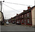
Row of houses, Lanelay Terrace, Pontypridd
The 40 metre long row is on the east side of Lanelay Terrace.
Image: © Jaggery
Taken: 19 Nov 2014
0.04 miles
4
Houses in Lanelay Terrace, Maesycoed, Pontypridd
Image: © John Lord
Taken: 30 Oct 2017
0.04 miles
5
Golygfa'r Eglwys in Pontypridd
Looking ESE from near this http://www.geograph.org.uk/photo/4254069 entrance to Barry Sidings Country Park. The houses on the south (right) side of Golygfa'r Eglwys are opposite the backs of houses in Seaton Street, behind railings.
Image: © Jaggery
Taken: 19 Nov 2014
0.05 miles
6
Former church, Golgafar Eglwys, Pontypridd
Image: © John Lord
Taken: 30 Oct 2017
0.05 miles
7
Conversion of the former St Mark?s Church, Pontypridd
Viewed across Seaton Street in November 2014. In March 2011, the Wales Online website reported the Parochial Church Council's announcement that St Mark's Church in the Church in Wales Diocese of Llandaff was to close after the church fell into financial hardship. Dwindling attendances, coupled with high rents, forced the closure. St Mark’s was built in 1892.
Image: © Jaggery
Taken: 19 Nov 2014
0.06 miles
8
Lanelay Terrace electricity substation, Pontypridd
The identifier on the Western Power Distribution electricity substation is
LANELAY TERRACE S/S 541036.
Image: © Jaggery
Taken: 19 Nov 2014
0.06 miles
9
Fay Court, Pontypridd
Flats on the east side of Lanelay Terrace.
Image: © Jaggery
Taken: 19 Nov 2014
0.08 miles
10
Hurford Street, Maesycoed, Pontypridd
Viewed across Mound Street.
Image: © Jaggery
Taken: 19 Nov 2014
0.08 miles


