1
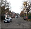
Access lane at the back of Woodland Terrace, Pontypridd
Image: © John Lord
Taken: 18 Feb 2012
0.02 miles
2
Woodland Terrace, Pontypridd
Viewed from the southern end, near this http://www.geograph.org.uk/photo/4253226 path from Gelliwion Road.
Image: © Jaggery
Taken: 19 Nov 2014
0.02 miles
3
East down Mound Road, Pontypridd
Mound Road descends from the Lanwern Road and Hurford Street junctions.
Image: © Jaggery
Taken: 19 Nov 2014
0.06 miles
4
Hermon Presbyterian Church, Maesycoed, Pontypridd
Image: © John Lord
Taken: 30 Oct 2017
0.07 miles
5
Mound Road houses, Pontypridd
On the south side of Mound Road, east of the Rosser Street junction. http://www.geograph.org.uk/photo/4253893
Image: © Jaggery
Taken: 19 Nov 2014
0.07 miles
6
Path from Gelliwion Road to Woodland Road, Pontypridd
The blue sign shows walkers on the left, cyclists on the right.
Image: © Jaggery
Taken: 19 Nov 2014
0.08 miles
7
Mound Rd, Maesycoed, Pontypridd
Image: © John Lord
Taken: 18 Feb 2012
0.08 miles
8
Wilfred Owen memorial stone in Pontypridd
Located at the southern end of Woodland Terrace. The inscription on the top of the stone is the word MINERS enclosed by a circle of words showing WILFRED OWEN 1893-1918. http://www.geograph.org.uk/photo/4253471 Underneath is the inscription of Owen's poem Miners. Owen wrote the poem after a mining disaster in January 1918 (though not in South Wales).
Wilfred Owen, one of the most famous of the Great War (First World War) poets, was born near Oswestry in 1893. He was killed in action in France on November 4th 1918, one week before the signing of the Armistice (the document which initiated the end of hostilities).
Image: © Jaggery
Taken: 19 Nov 2014
0.09 miles
9
Wilfred Owen memorial stone detail, Pontypridd
See http://www.geograph.org.uk/photo/4253462 for a wider view.
Image: © Jaggery
Taken: 19 Nov 2014
0.09 miles
10
Northern end of Rosser Street, Pontypridd
Viewed across Mound Road. A 20mph maximum speed zone applies
along Rosser Street, on the approach to Maes-y-Coed Primary School.
Image: © Jaggery
Taken: 19 Nov 2014
0.09 miles


