IMAGES TAKEN NEAR TO
Sanderling Close, PORTHCAWL, CF36 3TT
Introduction
This page details the photographs taken nearby to Sanderling Close, CF36 3TT by members of the Geograph project.
The Geograph project started in 2005 with the aim of publishing, organising and preserving representative images for every square kilometre of Great Britain, Ireland and the Isle of Man.

There are currently over 7.5m images from over14,400 individuals and you can help contribute to the project by visiting https://www.geograph.org.uk
Image Map
Images are licensed for reuse under creativecommons.org/licenses/by-sa/2.0
Notes
- Clicking on the map will re-center to the selected point.
- The higher the marker number, the further away the image location is from the centre of the postcode.
Image Listing (29 Images Found)
Images are licensed for reuse under creativecommons.org/licenses/by-sa/2.0
Image
Details
Distance
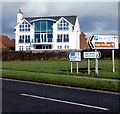
1
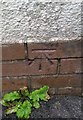
Ordnance Survey Cut Mark
This OS cut mark can be found on the Coast Guard Station, Locks Lane. It marks a point 21.781m above mean sea level.
Image: © Adrian Dust
Taken: 23 Oct 2017
0.12 miles
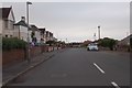
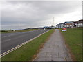
3
Road through Lock's Common, Porthcawl
From Mallard Way, the road leads to Rest Bay and the Royal Porthcawl Golf Club.
Image: © Jaggery
Taken: 27 Feb 2017
0.13 miles
4
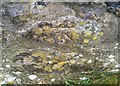
Ordnance Survey Cut Mark
This OS cut mark can be found on the wall SE side of Locks Lane. It marks a point 23.564m above mean sea level.
Image: © Adrian Dust
Taken: 23 Oct 2017
0.15 miles
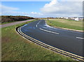
5
Directions and distances signs alongside Mallard Way, Porthcawl
Left (north) along Mallard Way for the M4 motorway (4 miles) and Nottage (1¼).
Right along Mallard Way for the town centre (1¼).
The large sign showing Rest Bay and Royal Porthcawl (Golf Club) points towards this http://www.geograph.org.uk/photo/5322246 road.
Image: © Jaggery
Taken: 27 Feb 2017
0.15 miles
6
Kittiwake Close, Porthcawl
Cul-de-sac viewed across Curlew Road.
Image: © Jaggery
Taken: 27 Feb 2017
0.15 miles
7
Mallard Way - viewed from Lock's Lane
Image: © Betty Longbottom
Taken: 26 Jun 2019
0.16 miles
8
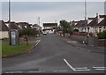
Springfield Avenue - Crossfield Avenue
Image: © Betty Longbottom
Taken: 26 Jun 2019
0.17 miles
9
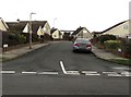
Redshank Close, Porthcawl
Cul-de-sac on the south side of Sandpiper Road.
Image: © Jaggery
Taken: 27 Feb 2017
0.17 miles
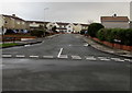
10
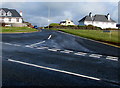
Junction of Mallard Way and Lock's Lane, Porthcawl
Lock's Lane heads away from Mallard Way.
Image: © Jaggery
Taken: 27 Feb 2017
0.17 miles