Directions and distances signs alongside Mallard Way, Porthcawl
Introduction
The photograph on this page of Directions and distances signs alongside Mallard Way, Porthcawl by Jaggery as part of the Geograph project.
The Geograph project started in 2005 with the aim of publishing, organising and preserving representative images for every square kilometre of Great Britain, Ireland and the Isle of Man.

There are currently over 7.5m images from over 14,400 individuals and you can help contribute to the project by visiting https://www.geograph.org.uk
Directions and distances signs alongside Mallard Way, Porthcawl
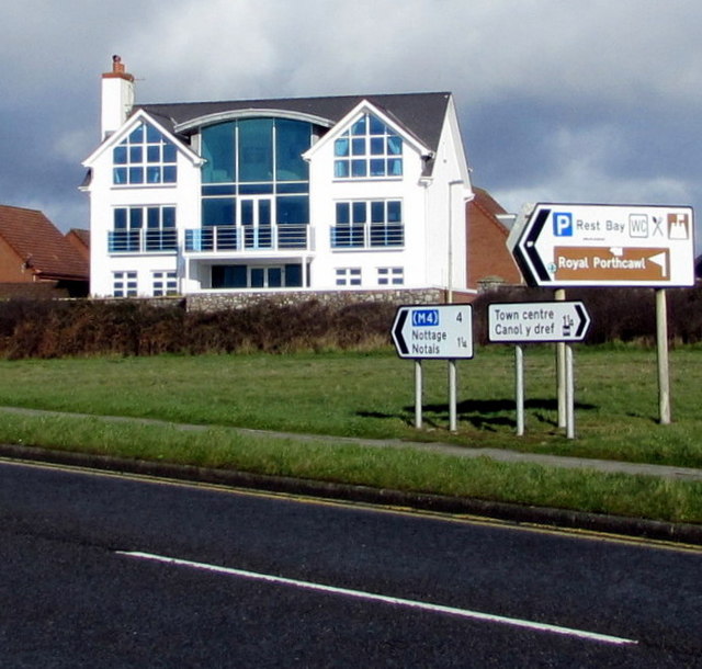
Image: © Jaggery Taken: 27 Feb 2017
Left (north) along Mallard Way for the M4 motorway (4 miles) and Nottage (1¼). Right along Mallard Way for the town centre (1¼). The large sign showing Rest Bay and Royal Porthcawl (Golf Club) points towards this http://www.geograph.org.uk/photo/5322246 road.
Images are licensed for reuse under creativecommons.org/licenses/by-sa/2.0
Image Location
Latitude
51.483393
Longitude
-3.718759