
IMAGES TAKEN NEAR TO
Greenfield Way, PORTHCAWL, CF36 3SH
Introduction
This page details the photographs taken nearby to Greenfield Way, CF36 3SH by members of the Geograph project.
The Geograph project started in 2005 with the aim of publishing, organising and preserving representative images for every square kilometre of Great Britain, Ireland and the Isle of Man.

There are currently over 7.5m images from over14,400 individuals and you can help contribute to the project by visiting https://www.geograph.org.uk
Image Map
Images are licensed for reuse under creativecommons.org/licenses/by-sa/2.0
Notes
- Clicking on the map will re-center to the selected point.
- The higher the marker number, the further away the image location is from the centre of the postcode.
Image Listing (73 Images Found)
Images are licensed for reuse under creativecommons.org/licenses/by-sa/2.0
Image
Details
Distance
1
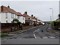
Westfield Crescent, Nottage, Porthcawl
Viewed across West Road. The sign on the left http://www.geograph.org.uk/photo/5320377 shows that Westfield Crescent leads to Greenfield Way and Connaught Close.
Image: © Jaggery
Taken: 16 Mar 2017
0.07 miles
2
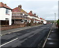
Westfield Crescent, Nottage, Porthcawl
From West Road, Westfield Crescent leads to Greenfield Way and Connaught Close.
Image: © Jaggery
Taken: 16 Mar 2017
0.07 miles
3
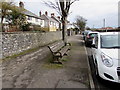
Coronation commemoration bench, West Road, Nottage
Located opposite West Park Primary School. A plaque on the bench records
PRESENTED BY NOTTAGE WOMENS INSTITUTE
IN COMMEMORATION OF THE
CORONATION OF QUEEN ELIZABETH II
JUNE 2ND 1953.
Image: © Jaggery
Taken: 16 Mar 2017
0.08 miles
4
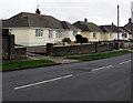
West Road bungalows, Nottage
Originally, bungalow was used in English for a lightly-built house, with a veranda and one storey.
In current UK usage it is a convenient word for any one-storey dwelling
Image: © Jaggery
Taken: 16 Mar 2017
0.09 miles
5
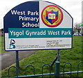
West Park Primary School nameboard, Nottage, Porthcawl
Facing West Road right here. http://www.geograph.org.uk/photo/5319847 The school is Ysgol Gynradd West Park in Welsh.
The school motto is Work, Persevere, Succeed.
Image: © Jaggery
Taken: 16 Mar 2017
0.09 miles
6
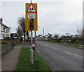
Warning sign School/Ysgol, West Road, Nottage, Porthcawl
The bilingual (English/Welsh) sign is on the approach to West Park Primary School. http://www.geograph.org.uk/photo/5319847
Image: © Jaggery
Taken: 16 Mar 2017
0.10 miles
7
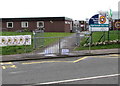
West Park Primary School, Nottage, Porthcawl
Viewed across West Road. The school opened in 1971.
Image: © Jaggery
Taken: 16 Mar 2017
0.10 miles
8
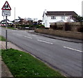
Warning sign School/Ysgol, West Road, Nottage
The bilingual (English/Welsh) sign is on the approach to West Park Primary School.
Image: © Jaggery
Taken: 16 Mar 2017
0.11 miles
9
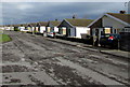
Heol Croes Faen bungalows, Nottage
Heol Croes Faen is a cul-de-sac on the east side of West Road.
Image: © Jaggery
Taken: 4 Mar 2017
0.12 miles
10
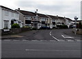
West Park Drive, Nottage
West Park Drive bends away from the West Road junction.
Image: © Jaggery
Taken: 16 Mar 2017
0.12 miles