1
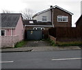
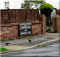
Flatholm Way, Nottage, Porthcawl
Cul-de-sac on the south side of Anglesey Way. Streets in this area are named after Welsh islands.
Image: © Jaggery
Taken: 16 Mar 2017
0.05 miles
2
Steepholm Close, Nottage, Porthcawl
Cul-de-sac on the south side of Anglesey Way. Streets in this area are named after Welsh islands.
Image: © Jaggery
Taken: 16 Mar 2017
0.07 miles
3
West Park Drive, Nottage
West Park Drive bends away from the West Road junction.
Image: © Jaggery
Taken: 16 Mar 2017
0.08 miles
4
West Road electricity substation, Nottage
The cabinet set back from West Road is a Western Power Distribution electricity substation.
Its identifier is S/S 563568. A notice on the cabinet warns DANGER 11,000 VOLTS.
Image: © Jaggery
Taken: 16 Mar 2017
0.08 miles
5
West Park Drive from Sker Walk
Image: © Colin Pyle
Taken: 1 Dec 2009
0.08 miles
6
Pink house, West Road, Nottage
The cabinet on the right http://www.geograph.org.uk/photo/5316641 is a Western Power Distribution electricity substation.
Image: © Jaggery
Taken: 16 Mar 2017
0.08 miles
7
Junction of Anglesey Way and West Road, Nottage, Porthcawl
Anglesey Way ends at the West Road junction ahead.
Image: © Jaggery
Taken: 16 Mar 2017
0.09 miles
8
Junction of West Road and Anglesey Way, Nottage, Porthcawl
Anglesey Way curves away from West Road.
Image: © Jaggery
Taken: 16 Mar 2017
0.09 miles
9
Bardsey Close, Nottage, Porthcawl
Small cul-de-sac on the north side of Anglesey Way. Streets in this area are named after Welsh islands.
Image: © Jaggery
Taken: 16 Mar 2017
0.09 miles
10
Monolingual street names sign on a Nottage corner, Porthcawl
On the left here. http://www.geograph.org.uk/photo/5320348 In March 2017, though many street names sign in Nottage are in both English and Welsh, some are in Welsh only, others are in English only, as here.
A large English/Welsh street names sign is nearby. http://www.geograph.org.uk/photo/5319968
Image: © Jaggery
Taken: 16 Mar 2017
0.10 miles


