
IMAGES TAKEN NEAR TO
Blackbirds Way, CARDIFF, CF3 5RF
Introduction
This page details the photographs taken nearby to Blackbirds Way, CF3 5RF by members of the Geograph project.
The Geograph project started in 2005 with the aim of publishing, organising and preserving representative images for every square kilometre of Great Britain, Ireland and the Isle of Man.

There are currently over 7.5m images from over14,400 individuals and you can help contribute to the project by visiting https://www.geograph.org.uk
Image Map
Images are licensed for reuse under creativecommons.org/licenses/by-sa/2.0
Notes
- Clicking on the map will re-center to the selected point.
- The higher the marker number, the further away the image location is from the centre of the postcode.
Image Listing (32 Images Found)
Images are licensed for reuse under creativecommons.org/licenses/by-sa/2.0
Image
Details
Distance
1
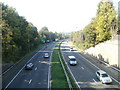
Eastern Avenue, Cardiff
Eastern Avenue (A48) heading west, viewed from the Tyr Winch Road bridge.
Image: © Jaggery
Taken: 11 Oct 2010
0.01 miles
2
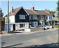
Old St Mellons : The Old Manse and oak-themed houses
Four houses on the west side of Tyr Winch Road, just north of the turning for Wern Fawr Lane.
Nearest the camera is The Old Manse. The other three houses are Oakdale, Oakdene and Oaklands.
Image: © Jaggery
Taken: 11 Oct 2010
0.06 miles
4
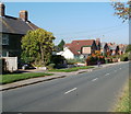
Tyr Winch Road north of Mill Lane, Old St Mellons
Houses on the west side of Tyr Winch Road, between Mill Lane and Wern Fawr Lane.
Image: © Jaggery
Taken: 11 Oct 2010
0.08 miles
5
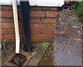
Ordnance Survey Cut Mark
This OS cut mark can be found on No317 Burnham Avenue. It marks a point 31.867m above mean sea level.
Image: © Adrian Dust
Taken: 29 Dec 2021
0.09 miles
6
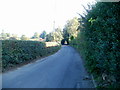
Old St Mellons : Bridge Road climbs towards residential area
Viewed from near the corner of Ruperra Close. http://www.geograph.org.uk/photo/2109030 Bridge Road (B4562) climbs towards houses at the western edge of Old St Mellons.
Image: © Jaggery
Taken: 11 Oct 2010
0.13 miles
7
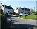
Eurwg Crescent, Old St Mellons
Viewed from Mill Lane.
Image: © Jaggery
Taken: 11 Oct 2010
0.13 miles
8
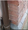
Ordnance Survey Cut Mark
This OS cut mark can be found on No4 Tyr Winch Road. It marks a point 42.291m above mean sea level.
Image: © Adrian Dust
Taken: 30 Dec 2018
0.13 miles
9

Bridge Road, Old St Mellons
Bridge Road heads away from Tyr Winch Road towards an arch-like bower of overhanging vegetation.
Image: © Jaggery
Taken: 11 Oct 2010
0.14 miles
10

Signpost opposite Bridge Road, Old St Mellons
The signpost indicates Cefn Mably and Michaelstone-y-Vedw to the left, St Mellons and Cardiff to the right, and Llanedeyrn facing the camera. Michaelstone-y-Vedw is now usually spelt Michaelston-y-Fedw. The road opposite the camera is the entrance to the residence Croesllechfaen.
Image: © Jaggery
Taken: 11 Oct 2010
0.14 miles