1
Meadow View bungalows, Blackmill
Derived from a Hindi word meaning in the style of Bengal, bungalow was originally used in English for a lightly-built house, with a veranda and one storey. In current UK usage it is a convenient word for any one-storey dwelling. The remains of a former railway bridge or viaduct are in the background.
Image: © Jaggery
Taken: 25 Aug 2018
0.00 miles
2
Meadow View, Blackmill
Meadow View is a cul-de-sac on the northeast side of the A4061.
Image: © Jaggery
Taken: 25 Aug 2018
0.03 miles
3
Blackmill and the western end of Cwm Ogwr Fach
A view over the Ogmore Valley/Cwm Ogwr to Cwm Ogwr Fach from a footpath on the Ogwr Ridgeway Walk. The village of Blackmill is seen in the foreground. Beyond, the white buildings on a hillside are houses at Glynllan (grid square
Image) in the west of Cwm Ogwr Fach. In between, relatively new red brick houses are situated more-or-less at the mouth of that valley. Finally, in the right half of the picture, the whites of buildings in the hilltop village of Glynogwr (grid square
Image) can just be made out.
Image: © eswales
Taken: 25 Oct 2013
0.03 miles
4
Piers from dismantled viaduct
These ruins once carried a railway over the road from which I took the shot, and the river valley below. This is one of a number of dead railways in the area.
Image: © Ruth Sharville
Taken: 23 Jun 2007
0.03 miles
5
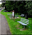
Roadside benches in Blackmill
On the east side of the A4061, on a bank of the Ogwr Fawr river.
Image: © Jaggery
Taken: 25 Aug 2018
0.04 miles
6
A4061 bus stop and shelter, Blackmill
This stop on the east side of the A4061 is for buses to Bridgend.
Image: © Jaggery
Taken: 25 Aug 2018
0.04 miles
7
River footbridge, Blackmill
Parallel with the A4061 road bridge on the left, the footbridge carries the pavement over the Ogwr Fach river.
Image: © Jaggery
Taken: 25 Aug 2018
0.04 miles
8
Warning sign - Blind summit, Blackmill
Facing traffic ascending the A4061. The text is also in Welsh.
Image: © Jaggery
Taken: 25 Aug 2018
0.04 miles
9
Blackmill from above
Part of the village – including some fairly new housing – viewed from a footpath on hillside to its west.
Image: © eswales
Taken: 25 Oct 2013
0.04 miles
10
Blackmill : Blackmill Road
Heading through the small village of Blackmill in the Bridgend District.
Image: © Lewis Clarke
Taken: 23 Mar 2014
0.05 miles


