Blackmill and the western end of Cwm Ogwr Fach
Introduction
The photograph on this page of Blackmill and the western end of Cwm Ogwr Fach by eswales as part of the Geograph project.
The Geograph project started in 2005 with the aim of publishing, organising and preserving representative images for every square kilometre of Great Britain, Ireland and the Isle of Man.

There are currently over 7.5m images from over 14,400 individuals and you can help contribute to the project by visiting https://www.geograph.org.uk
Blackmill and the western end of Cwm Ogwr Fach
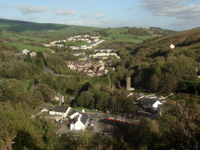
Image: © eswales Taken: 25 Oct 2013
A view over the Ogmore Valley/Cwm Ogwr to Cwm Ogwr Fach from a footpath on the Ogwr Ridgeway Walk. The village of Blackmill is seen in the foreground. Beyond, the white buildings on a hillside are houses at Glynllan (grid square Image) in the west of Cwm Ogwr Fach. In between, relatively new red brick houses are situated more-or-less at the mouth of that valley. Finally, in the right half of the picture, the whites of buildings in the hilltop village of Glynogwr (grid square Image) can just be made out.
Images are licensed for reuse under creativecommons.org/licenses/by-sa/2.0
Image Location


Leaflet Map data © OpenStreetMap
Latitude
51.569236
Longitude
-3.539161