1
Old Milestone by Coychurch Road, Pencoed
Stone post by the UC road (was A473), in parish of Pencoed (Bridgend County Borough District), Coychurch Road, Pencoed, against wall of bungalow "Cartref".
TO
BRIDGEND
4
LANTRISSENT
7
Grade II listed by Cadw.
Reference Number: 19477 https://cadwpublic-api.azurewebsites.net/reports/listedbuilding/FullReport?lang=&id=19477
Surveyed
Milestone Society National ID: GLA_BELT04
Image: © Milestone Society
Taken: Unknown
0.05 miles
2
Recently-built houses, Coychurch Road, Pencoed
Viewed in November 2014. This was the location of the Maerdy Hotel http://www.geograph.org.uk/photo/2266982 which was demolished in 2013.
Image: © Jaggery
Taken: 9 Nov 2014
0.06 miles
3
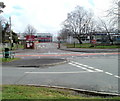
Entrance to two schools, Coychurch Road, Pencoed
Viewed across Coychurch Road from the edge of Hafod Las. The entrance road is into Pencoed Comprehensive School and Croesty Primary School.
Image: © Jaggery
Taken: 12 Feb 2011
0.08 miles
4
Maximum speed 5mph in the school grounds, Pencoed
Coychurch Road entrance to two schools, Pencoed Comprehensive School and Croesty Primary School.
Image: © Jaggery
Taken: 9 Nov 2014
0.09 miles
5
Maerdy Hotel, Pencoed
3-star hotel and conference centre, Coychurch Road.
UPDATE The hotel was demolished in 2013.
This http://www.geograph.org.uk/photo/4387774 November 2014 view shows recently-built houses on the site.
Image: © Jaggery
Taken: 12 Feb 2011
0.09 miles
6
Distinctively roofed house, Heol Croesty, Pencoed
House on the corner of Heol Croesty, viewed across Coychurch Road.
Image: © Jaggery
Taken: 12 Feb 2011
0.09 miles
7
Pencoed Comprehensive School
Secondary school on Coychurch Road: http://www.pencoedcs.bridgend.sch.uk/
Image: © Mike Faherty
Taken: 12 Jul 2016
0.10 miles
8
Ton Teg and Hafod Las, Pencoed
Looking along Hafod Las from the edge of Coychurch Road. Hafod Las continues on the right (north) ; Ton Teg is on the left
Image: © Jaggery
Taken: 12 Feb 2011
0.11 miles
9
Heol Bryncwtyn, Pencoed
Cul-de-sac on the north side of Heol Maes-yr-Haf.
Image: © Jaggery
Taken: 9 Nov 2014
0.11 miles
10
Heol Pantruthin, Pencoed
Cul-de-sac on the north side of Heol Maes-yr-Haf.
Image: © Jaggery
Taken: 9 Nov 2014
0.12 miles


