Old Milestone by Coychurch Road, Pencoed
Introduction
The photograph on this page of Old Milestone by Coychurch Road, Pencoed by Milestone Society as part of the Geograph project.
The Geograph project started in 2005 with the aim of publishing, organising and preserving representative images for every square kilometre of Great Britain, Ireland and the Isle of Man.

There are currently over 7.5m images from over 14,400 individuals and you can help contribute to the project by visiting https://www.geograph.org.uk
Old Milestone by Coychurch Road, Pencoed
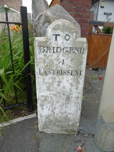
Image: © Milestone Society Taken: Unknown
Stone post by the UC road (was A473), in parish of Pencoed (Bridgend County Borough District), Coychurch Road, Pencoed, against wall of bungalow "Cartref". TO BRIDGEND 4 LANTRISSENT 7 Grade II listed by Cadw. Reference Number: 19477 https://cadwpublic-api.azurewebsites.net/reports/listedbuilding/FullReport?lang=&id=19477 Surveyed Milestone Society National ID: GLA_BELT04
Images are licensed for reuse under creativecommons.org/licenses/by-sa/2.0
Image Location
Latitude
51.518006
Longitude
-3.503952