
IMAGES TAKEN NEAR TO
Cross Street, MAESTEG, CF34 9YT
Introduction
This page details the photographs taken nearby to Cross Street, CF34 9YT by members of the Geograph project.
The Geograph project started in 2005 with the aim of publishing, organising and preserving representative images for every square kilometre of Great Britain, Ireland and the Isle of Man.

There are currently over 7.5m images from over14,400 individuals and you can help contribute to the project by visiting https://www.geograph.org.uk
Image Map
Images are licensed for reuse under creativecommons.org/licenses/by-sa/2.0
Notes
- Clicking on the map will re-center to the selected point.
- The higher the marker number, the further away the image location is from the centre of the postcode.
Image Listing (187 Images Found)
Images are licensed for reuse under creativecommons.org/licenses/by-sa/2.0
Image
Details
Distance
1
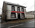
Queens Hotel, Maesteg
Viewed from the corner of Ferriers Row, Queens Hotel is at 69 Castle Street.
From information on the name sign, it appears to be a pub with B&B accommodation.
Image: © Jaggery
Taken: 30 Oct 2014
0.03 miles
2
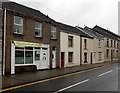
Extending Lengths in Maesteg
Hair extensions & unisex salon at 63 Castle Street.
Image: © Jaggery
Taken: 30 Oct 2014
0.04 miles
3
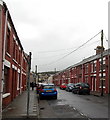
Temple Street, Maesteg
Looking SSW from the Castle Street end.
Image: © Jaggery
Taken: 30 Oct 2014
0.04 miles
4
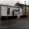
The Salvation Army Maesteg Corps
Located in Castle Street Maesteg, part of The Salvation Army South and Mid Wales Division.
Image: © Jaggery
Taken: 30 Oct 2014
0.04 miles
5
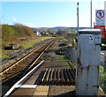
Eastern end of Maesteg railway station
Maesteg is the terminus of the line from Bridgend. The next station is Ewenny Road, about 750 metres, or half a mile, away. A notice on the grey box states Special Telephone Not For 999 Calls.
Image: © Jaggery
Taken: 17 Nov 2011
0.04 miles
6
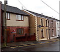
Old Carmel Chapel, Maesteg
It was only the much newer appearance of the house on the left, compared with adjacent houses in Temple Street, that caused me to look at its name - Old Carmel Chapel. I concluded that the old chapel was either demolished or completely rebuilt to produce the house seen here in 2014.
Image: © Jaggery
Taken: 30 Oct 2014
0.05 miles
7
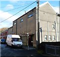
Maesteg Workingmens Club
Located on the corner of Temple Street and Cross Street.
The building occupies the site of the original Tabor Methodist Chapel, where the Welsh National Anthem was first heard in public, performed by Elizabeth John.
Image: © Jaggery
Taken: 17 Nov 2011
0.05 miles
8
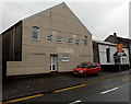
Bethel Community Church in Maesteg
Not apparent in this view, the church building extends back 35 metres from the south side of Castle Street. Viewed in late October 2014. The name on the building in a Google Earth Street View taken in June 2011 was Hope Church. The Salvation Army Maesteg Corps building http://www.geograph.org.uk/photo/4225527 is on the right.
Image: © Jaggery
Taken: 30 Oct 2014
0.05 miles
9
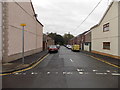
Goodwin Street, Maesteg
80 metre long dead-end street viewed from Meadow Street.
Image: © Jaggery
Taken: 30 Oct 2014
0.05 miles
10
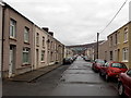
North along Meadow Street, Maesteg
Viewed from near the river footbridge http://www.geograph.org.uk/photo/4229075 from Commercial Street,
looking towards Castle Street 200 metres ahead.
Image: © Jaggery
Taken: 30 Oct 2014
0.06 miles