IMAGES TAKEN NEAR TO
Station Road, MAESTEG, CF34 9TF

Introduction

This page details the photographs taken nearby to Station Road, CF34 9TF by members of the Geograph project.

The Geograph project started in 2005 with the aim of publishing, organising and preserving representative images for every square kilometre of Great Britain, Ireland and the Isle of Man.

There are currently over 7.5m images from over14,400 individuals and you can help contribute to the project by visiting https://www.geograph.org.uk

Image Map


Images are licensed for reuse under creativecommons.org/licenses/by-sa/2.0
Notes
  • Clicking on the map will re-center to the selected point.
  • The higher the marker number, the further away the image location is from the centre of the postcode.

Image Listing (58 Images Found)

Images are licensed for reuse under creativecommons.org/licenses/by-sa/2.0
  • ...
Image
Details
Distance
1
Llangynwyd railway station (site), Bridgend
Opened in 1864 on the Llynvi & Ogmore Railway's line from Pyle to Cymmer, this station closed in 1970. View north west towards Troedyrhiw Garth and Cymmer, although when this image was taken, the line only went as far as Maesteg. One of the two former platforms can be seen to the left of the line.
Image: © Nigel Thompson Taken: 16 Aug 2014
0.03 miles
2
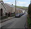
Down Station Road, Llangynwyd
This was formerly the way to Llangynwyd railway station which closed in 1970. Ainon Welsh Baptist Chapel http://www.geograph.org.uk/photo/5292655 is on the left.
Image: © Jaggery Taken: 24 Feb 2017
0.04 miles
3
The Railway
The stone walls are the railway bridge
Image: © John Lord Taken: 29 Aug 2008
0.04 miles
4
Ordnance Survey Cut Mark
This OS cut mark can be found on the SE parapet of the railway bridge. It marks a point 101.740m above mean sea level.
Image: © Adrian Dust Taken: 7 Mar 2021
0.04 miles
5
Ordnance Survey Cut Mark
This OS cut mark can be found on the south parapet of the railway bridge. It marks a point 101.740m above mean sea level.
Image: © Adrian Dust Taken: 9 Mar 2016
0.04 miles
6
The Railway
Image: © John Lord Taken: 29 Aug 2008
0.05 miles
7
Ainon Chapel
Ainon Chapel, Llangynwyd.
Image: © Alan Hughes Taken: 19 Jan 2017
0.06 miles
8
Railway in cutting, Pont Rhyd-y-cyff
Northward view from road bridge of the Bridgend-Maesteg line as it passes through a shallow cutting.
Image: © eswales Taken: 19 Nov 2008
0.07 miles
9
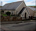
Ainon Welsh Baptist Chapel, Llangynwyd
On the north side of Station Road. The inscription in Welsh on a tablet above the doorway records that Ainon Baptist Chapel was incorporated in 1884 and that this building was erected in 1925.
Image: © Jaggery Taken: 24 Feb 2017
0.07 miles
10
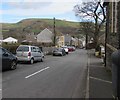
Station Road, Llangynwyd
Station Road descends from the corner of the A4063 Bridgend Road. This was formerly the way to Llangynwyd railway station which closed in 1970.
Image: © Jaggery Taken: 24 Feb 2017
0.07 miles
  • ...