1
SE side of town hall and market, Maesteg
Viewed from the Church Street side. The clock tower on the NE side of the building immediately catches the eye. The First Cymru bus is at the edge of Maesteg bus station. http://www.geograph.org.uk/photo/2699458
Image: © Jaggery
Taken: 17 Nov 2011
0.01 miles
2
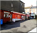
Three businesses, Maesteg Market
Maesteg Market is situated on the SE side of Talbot Street in the town centre retail area. It consists of permanent indoor stalls, and casual and permanent outdoor stalls.
Seen here are three business in the NW corner of the market site, viewed looking towards Talbot Street.
On the left is Valley Gold, jewellery repair workshop and key cutting.
In the middle is The Card Shop - "a card for every occasion".
On the right is Andrews Family Butcher.
Image: © Jaggery
Taken: 17 Nov 2011
0.01 miles
3
Lloyds TSB, Maesteg
Town centre bank branch at 19 Talbot Street.
UPDATE The bank has been TSB http://www.geograph.org.uk/photo/4225912 since the autumn of 2013.
Image: © Jaggery
Taken: 17 Nov 2011
0.01 miles
4
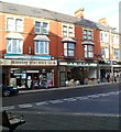
Two Talbot Street businesses, Maesteg
On the left is Maesteg Pharmacy, 20 Talbot Street. Next door is 21 Cafe at 21 Talbot Street.
Image: © Jaggery
Taken: 17 Nov 2011
0.01 miles
5
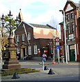
Maesteg Monument
The monument commemorates Dr. William H.Thomas who was a prominent surgeon, practising in the area between 1867 and 1899. Maesteg post office http://www.geograph.org.uk/photo/2955739 is on the left. Grade II listed Colonel North Memorial Hall http://www.geograph.org.uk/photo/2955802 is on the right.
Image: © Jaggery
Taken: 17 Nov 2011
0.01 miles
6
Grade II* listed Maesteg Council Offices
Located behind the town hall on the south side of Talbot Street.
Built in 1914. Grade II* listed in July 1997.
Image: © Jaggery
Taken: 17 Nov 2011
0.01 miles
7
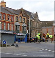
Mounted police, Maesteg
Two female police officers on horseback are in Talbot Street near the memorial. http://www.geograph.org.uk/photo/2955820
Image: © Jaggery
Taken: 17 Nov 2011
0.01 miles
8
No entry to a narrow lane to Talbot Street, Maesteg
Viewed from Plasnewydd Street. I was surprised that this is a route for vehicles.
One-way signs point this way from Talbot Street.
Image: © Jaggery
Taken: 25 Feb 2015
0.03 miles
9
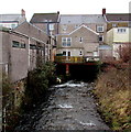
Llynfi flows under a dental surgery, Maesteg
Viewed from a footbridge at the western end of Plasnewydd Street.
The name on a window is Llynfi dental.
Image: © Jaggery
Taken: 25 Feb 2015
0.03 miles
10
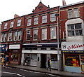
NatWest in an Edwardian building in Maesteg
The bank branch is at 15 Talbot Street. Inscribed in stone on the brick triangle
at the top of the building is the year 1903, during the reign of King Edward VII.
Image: © Jaggery
Taken: 30 Oct 2014
0.04 miles


