
IMAGES TAKEN NEAR TO
Blaencaerau Road, MAESTEG, CF34 0PP
Introduction
This page details the photographs taken nearby to Blaencaerau Road, CF34 0PP by members of the Geograph project.
The Geograph project started in 2005 with the aim of publishing, organising and preserving representative images for every square kilometre of Great Britain, Ireland and the Isle of Man.

There are currently over 7.5m images from over14,400 individuals and you can help contribute to the project by visiting https://www.geograph.org.uk
Image Map
Images are licensed for reuse under creativecommons.org/licenses/by-sa/2.0
Notes
- Clicking on the map will re-center to the selected point.
- The higher the marker number, the further away the image location is from the centre of the postcode.
Image Listing (56 Images Found)
Images are licensed for reuse under creativecommons.org/licenses/by-sa/2.0
Image
Details
Distance
1
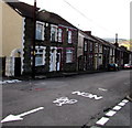
White arrow on Blaencaerau Road, Caerau
Pointing towards National Cycle Network route 885.
Image: © Jaggery
Taken: 27 Feb 2015
0.02 miles
2
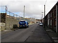
Southern edge of a former school site in Caerau
Viewed from Blaencaerau Road in February 2015. The railings are at the edge of the former Blaencaerau Junior School, now demolished. The building became redundant on the amalgamation of Caerau Nursery School, Blaenllynfi Infants School and Blaencaerau Junior School to create Caerau Primary School http://www.geograph.org.uk/photo/4373550 which opened on a purpose-built site in December 2009.
Image: © Jaggery
Taken: 27 Feb 2015
0.02 miles
4
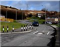
Traffic calming in the Blaencaerau Estate, Caerau
A speed bump and a short narrowing of the road are designed to slow down vehicles in this residential area.
Image: © Jaggery
Taken: 27 Feb 2015
0.05 miles
5

Blaencaerau Road, Caerau
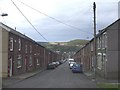
Houses at the NE edge of Caerau, near the Blaencaerau Estate.
Image: © Jaggery
Taken: 27 Feb 2015
0.05 miles
6
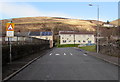
Side road from Blaencaerau Road to Brynglas Terrace, Caerau
The wall on the left is the eastern edge of the former Blaencaerau Junior School, now demolished. The building became redundant on the amalgamation of Caerau Nursery School, Blaenllynfi Infants School and Blaencaerau Junior School to create Caerau Primary School http://www.geograph.org.uk/photo/4373550 which opened on a purpose-built site in December 2009.
Image: © Jaggery
Taken: 27 Feb 2015
0.05 miles
7
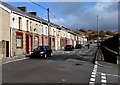
Brynglas Terrace, Caerau
The houses face the site of the former Blaencaerau Junior School, now demolished. The building became redundant on the amalgamation of Caerau Nursery School, Blaenllynfi Infants School and Blaencaerau Junior School to create Caerau Primary School http://www.geograph.org.uk/photo/4373550 which opened on a purpose-built site in December 2009.
Image: © Jaggery
Taken: 27 Feb 2015
0.05 miles
8
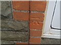
Ordnance Survey Cut Mark
This OS cut mark can be found on No26 Blaencaerau Road. It marks a point 219.295m above mean sea level.
Image: © Adrian Dust
Taken: 24 Nov 2020
0.05 miles
9
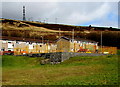
Yellow-fenced play area in the Blaencaerau Estate, Caerau
Image: © Jaggery
Taken: 27 Feb 2015
0.06 miles
10
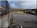
Site of the former Blaencaerau Junior School, Caerau
The school was demolished after becoming redundant on the amalgamation of Caerau Nursery School, Blaenllynfi Infants School and Blaencaerau Junior School to create Caerau Primary School http://www.geograph.org.uk/photo/4373550 which opened on a purpose-built site in December 2009.
Image: © Jaggery
Taken: 27 Feb 2015
0.06 miles