
IMAGES TAKEN NEAR TO
High Street, MAESTEG, CF34 0BW
Introduction
This page details the photographs taken nearby to High Street, CF34 0BW by members of the Geograph project.
The Geograph project started in 2005 with the aim of publishing, organising and preserving representative images for every square kilometre of Great Britain, Ireland and the Isle of Man.

There are currently over 7.5m images from over14,400 individuals and you can help contribute to the project by visiting https://www.geograph.org.uk
Image Map
Images are licensed for reuse under creativecommons.org/licenses/by-sa/2.0
Notes
- Clicking on the map will re-center to the selected point.
- The higher the marker number, the further away the image location is from the centre of the postcode.
Image Listing (58 Images Found)
Images are licensed for reuse under creativecommons.org/licenses/by-sa/2.0
Image
Details
Distance
1
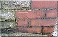
Ordnance Survey Cut Mark
This OS cut mark can be found on the Traveller's Rest, High Street. It marks a point 145.576m above mean sea level.
Image: © Adrian Dust
Taken: 10 Nov 2020
0.01 miles
2
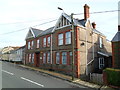
Travellers Rest, Nantyffyllon
Pub at 95 High Street.
Image: © Jaggery
Taken: 17 Nov 2011
0.03 miles
3
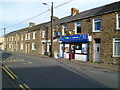
High Street Stores & Off Licence, Nantyffyllon
The Lifestyle Express shop was formerly Moruzzi's General Store.
Image: © Jaggery
Taken: 17 Nov 2011
0.04 miles
4
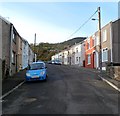
Union Street, Nantyffyllon
Viewed from the High Street end looking towards Uplands Drive.
Image: © Jaggery
Taken: 17 Nov 2011
0.07 miles
5
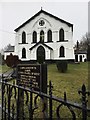
Sharon Chapel of Rest
Built in 1852 as an independent chapel, Sharon is now a chapel of rest. It is a grade 2 listed building.
Image: © Alan Hughes
Taken: 1 Feb 2017
0.07 miles
6
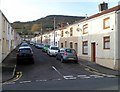
John Street, Nantyffyllon
Viewed from the High Street end looking towards Uplands Drive.
Image: © Jaggery
Taken: 17 Nov 2011
0.07 miles
7
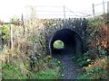
Former railway bridge, Nantyffyllon
A track passes under a stone bridge that formerly carried a railway on the east bank of the River Llynfi.
Image: © Jaggery
Taken: 17 Nov 2011
0.07 miles
8
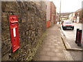
Nantyffyllon: postbox № CF34 10, High Street
A Victorian postbox set into a wall on the main road, along which we are looking towards Maesteg. The box is currently missing its collection-times plate.
Image: © Chris Downer
Taken: 1 Feb 2010
0.08 miles
9
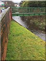
Footbridge at Nantyffyllon
Footbridge over the Llynfi at Nantyffyllon.
Image: © Alan Hughes
Taken: 1 Feb 2017
0.08 miles
10
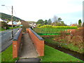
Ramp to a footbridge across the River Llynfi, Nantyffyllon
Alongside High Street (the A4063).
Image: © Jaggery
Taken: 17 Nov 2011
0.09 miles