
IMAGES TAKEN NEAR TO
Forge Industrial Estate, Nantyfyllon, MAESTEG, CF34 0AH
Introduction
This page details the photographs taken nearby to Forge Industrial Estate, Nantyfyllon, CF34 0AH by members of the Geograph project.
The Geograph project started in 2005 with the aim of publishing, organising and preserving representative images for every square kilometre of Great Britain, Ireland and the Isle of Man.

There are currently over 7.5m images from over14,400 individuals and you can help contribute to the project by visiting https://www.geograph.org.uk
Image Map
Images are licensed for reuse under creativecommons.org/licenses/by-sa/2.0
Notes
- Clicking on the map will re-center to the selected point.
- The higher the marker number, the further away the image location is from the centre of the postcode.
Image Listing (35 Images Found)
Images are licensed for reuse under creativecommons.org/licenses/by-sa/2.0
Image
Details
Distance
1
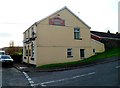
Masons Arms, Nantyffyllon
Pub on the corner of High Street and Duffryn Madog.
Image: © Jaggery
Taken: 17 Nov 2011
0.03 miles
2
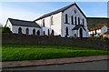
Llynfi Chapel of Rest (former Saron Chapel), Nantyffyllon
Set back from, and above, the west side of High Street. The former chapel is now Llynfi Chapel of Rest, the premises of Bowen & Thomas Funeral Services and Allan Phillips, Monumental Masons.
The chapel is a 1900 rebuild of the original dating from 1852.
Image: © Jaggery
Taken: 17 Nov 2011
0.03 miles
3
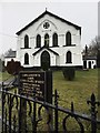
Sharon Chapel of Rest
Built in 1852 as an independent chapel, Sharon is now a chapel of rest. It is a grade 2 listed building.
Image: © Alan Hughes
Taken: 1 Feb 2017
0.08 miles
4
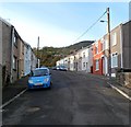
Union Street, Nantyffyllon
Viewed from the High Street end looking towards Uplands Drive.
Image: © Jaggery
Taken: 17 Nov 2011
0.08 miles
5
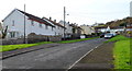
Duffryn Madog, Nantyffyllon
The residential road Duffryn Madog climbs away from the Masons Arms http://www.geograph.org.uk/photo/3007783 corner.
Image: © Jaggery
Taken: 17 Nov 2011
0.09 miles
6
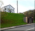
High Street urinal, Nantyffyllon
The small brick building at the side of the road is a basic urinal (no pedestals or wash basins).
Llynfi Chapel of Rest (the former Saron Chapel) http://www.geograph.org.uk/photo/3007722 is in the background.
Image: © Jaggery
Taken: 17 Nov 2011
0.09 miles
7
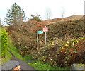
Do not trespass on the (non-existent) railway, Nantyffyllon
Viewed from this http://www.geograph.org.uk/photo/3006477 footbridge. The red notice, left in place after the removal of railway lines many years ago, shows Warning do not trespass on the Railway Penalty £200.
The green sign points right along a public footpath.
Image: © Jaggery
Taken: 17 Nov 2011
0.09 miles
8
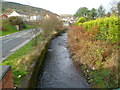
River Llynfi flows alongside High Street Nantyffyllon
Viewed from this http://www.geograph.org.uk/photo/3006477 footbridge.
Image: © Jaggery
Taken: 17 Nov 2011
0.09 miles
9
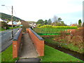
Ramp to a footbridge across the River Llynfi, Nantyffyllon
Alongside High Street (the A4063).
Image: © Jaggery
Taken: 17 Nov 2011
0.09 miles
10
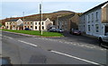
Semicircle of houses, High Street, Nantyffyllon
Viewed from near a coal dram http://www.geograph.org.uk/photo/3006260 at the boundary of Maesteg and Nantyffyllon. The houses are on the west bank of the River Llynfi.
Image: © Jaggery
Taken: 17 Nov 2011
0.10 miles