1
Two rugby pitches, Kenfig Hill
This is the home ground of Kenfig Hill Rugby Football Club.
The playing fields are bordered by Pisgah Street to the south and Bryn Llawen to the north.
Image: © Jaggery
Taken: 29 Nov 2012
0.04 miles
2
Eastern side of Kenfig Hill RFC's home ground
Viewed from the Pisgah Street/Bridge Street side.
This is the home ground of Kenfig Hill Rugby Football Club.
Image: © Jaggery
Taken: 29 Nov 2012
0.09 miles
3
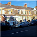
Pisgah Street News, Kenfig Hill
Newsagents and off-licence at 74 Pisgah Street.
Image: © Jaggery
Taken: 29 Nov 2012
0.16 miles
4
Geezers barber shop, Pisgah Street, Kenfig Hill
The shutters are down at lunch time on a Thursday.
Has the barber shop shut for lunch or has the business closed down?
Image: © Jaggery
Taken: 29 Nov 2012
0.16 miles
5
Ordnance Survey Cut Mark
This OS cut mark can be found on a concrete post SE side of Pont George Road. It marks a point 43.111m above mean sea level.
Image: © Adrian Dust
Taken: 18 Aug 2021
0.17 miles
6
National Cycle Route 4 at Kenfig Hill
Part of an off-road section of the long distance cycle route at Kenfig Hill. According to the sign in the foreground, the stretch of cycle track seen is also a permissive bridleway. In common with the rest of the off-road section of National Cycle Route 4 at Kenfig Hill, the stretch of cycle path seen runs along the course of the former Dyffryn Llynfi & Porthcawl Railway.
Image: © eswales
Taken: 15 Jun 2022
0.17 miles
7
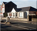
Barrie David dental practice, Kenfig Hill
The single-storey building at 88 Pisgah Street is the dental practice of Barrie David & Associates.
Image: © Jaggery
Taken: 29 Nov 2012
0.17 miles
8
Ordnance Survey Rivet
This OS rivet can be found on the wall of the Pisgah Chapel, Pisgah Street. It marks a point 51.517m above mean sea level.
Image: © Adrian Dust
Taken: 18 Aug 2021
0.17 miles
9
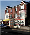
Ladbrokes and Royal Garden, Kenfig Hill
The two Pisgah Street businesses are a Ladbrokes betting shop
and Royal Garden Chinese and Cantonese cuisine takeaway.
Image: © Jaggery
Taken: 29 Nov 2012
0.17 miles
10
Kenfig Hill
Looking down Bridge Street towards Pisgah Street
Image: © Chris Shaw
Taken: Unknown
0.18 miles


