1
Llys Ton, Kenfig Hill
Llys Ton was built in 2011 on the Waunbant Road site of the demolished Troed y Ton care home.
The purpose-built complex provides accommodation for 70 older people in 40 flats.
There is an on-site care staff, a non-resident management team and community alarm service.
The literal translation of Llys Ton is Wave Court but Ton is also the name of a nearby hill.
Image: © Jaggery
Taken: 29 Nov 2012
0.11 miles
2
Pen y castell
Looking up to the hill summit from the B4281 at Kenfig Hill. The triangulation point is visible, (although slightly obscured by a bush) to the left of the rightmost tree.
Image: © Chris Shaw
Taken: Unknown
0.17 miles
3
Cycle path at Pyle
A view part way along a cycle path which runs for nearly a kilometre along some of the route of the former Dyffryn Llynfi & Porthcawl Railway. Frog Pond Wood Nature Reserve lies at the southern end of the path.
Access to and from the road Woodlands Park is possible through the cycle barrier seen.
The cycle path is not a part of National Cycle Route 4. The latter passes through the area a short distance to the north.
Image: © eswales
Taken: 15 Jun 2022
0.19 miles
4
Kenfig Hill Clinic
The inscription in stone above the doorway of the Waunbant Road building is
CHILD WELFARE CLINIC
KENFIG HILL
1938.
Image: © Jaggery
Taken: 29 Nov 2012
0.19 miles
5
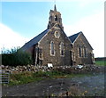
St.Theodore's Church, Kenfig Hill
St.Theodore's Church from the southwest.
Image: © Alan Hughes
Taken: 7 Jun 2016
0.19 miles
6
St.Theodore's Church, Kenfig Hill
St.Theodore's Church from the northeast.
Image: © Alan Hughes
Taken: 7 Jun 2016
0.19 miles
7
St Theodore's Church, Kenfig Hill
The church is located on the south side of High Street (the B4281) almost opposite the School Road junction. The foundation stone of St Theodore's was laid on September 19th 1889. The church is dedicated to Saint Theodore of Tarsus, who was born in Tarsus, Greece, in 602 AD. He was the eighth Archbishop of Canterbury, from 668 until his death aged 88 on September 19th 690.
Image: © Jaggery
Taken: 29 Nov 2012
0.20 miles
8
Ordnance Survey Cut Mark
This OS cut mark can be found on the NW angle of St Theodore's Church. It marks a point 94.505m above mean sea level.
Image: © Adrian Dust
Taken: 4 May 2015
0.20 miles
9
Waunbant Road looking east
Image: © Colin Pyle
Taken: 27 Aug 2010
0.21 miles
10
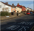
Looking from Moriah Place into High Street, Kenfig Hill
This view eastwards along the B4281 shows two street name signs.
The one on the left shows Moriah Place. The other one shows High Street.
Image: © Jaggery
Taken: 29 Nov 2012
0.21 miles


