1
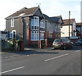
Llys Ton, Kenfig Hill
Llys Ton was built in 2011 on the Waunbant Road site of the demolished Troed y Ton care home.
The purpose-built complex provides accommodation for 70 older people in 40 flats.
There is an on-site care staff, a non-resident management team and community alarm service.
The literal translation of Llys Ton is Wave Court but Ton is also the name of a nearby hill.
Image: © Jaggery
Taken: 29 Nov 2012
0.08 miles
2
Cycle path at Pyle
A view part way along a cycle path which runs for nearly a kilometre along some of the route of the former Dyffryn Llynfi & Porthcawl Railway. Frog Pond Wood Nature Reserve lies at the southern end of the path.
Access to and from the road Woodlands Park is possible through the cycle barrier seen.
The cycle path is not a part of National Cycle Route 4. The latter passes through the area a short distance to the north.
Image: © eswales
Taken: 15 Jun 2022
0.13 miles
3
Kenfig Hill Clinic
The inscription in stone above the doorway of the Waunbant Road building is
CHILD WELFARE CLINIC
KENFIG HILL
1938.
Image: © Jaggery
Taken: 29 Nov 2012
0.18 miles
4
Waunbant Road looking east
Image: © Colin Pyle
Taken: 27 Aug 2010
0.19 miles
5
Pen y castell
Looking up to the hill summit from the B4281 at Kenfig Hill. The triangulation point is visible, (although slightly obscured by a bush) to the left of the rightmost tree.
Image: © Chris Shaw
Taken: Unknown
0.22 miles
6
Waunbant Road houses, Kenfig Hill
Viewed from near Kenfig Hill Clinic. http://www.geograph.org.uk/photo/3260294
Waunbant Road is also known locally as Stormy Road, because it leads to Stormy Down near Bridgend.
Image: © Jaggery
Taken: 29 Nov 2012
0.22 miles
7
The Old Telephone Exchange, Kenfig Hill
Now in residential use, this Waunbant Road building bears the nameplate The Old Telephone Exchange. Doubtless it has been much altered, internally and externally, since its change of use.
The coaches in the background are at the edge of the Express Motors depot.
Image: © Jaggery
Taken: 29 Nov 2012
0.24 miles
8
St.Theodore's Church, Kenfig Hill
St.Theodore's Church from the southwest.
Image: © Alan Hughes
Taken: 7 Jun 2016
0.24 miles
9
Waunbant Road approaching Commercial Street
Image: © Colin Pyle
Taken: 27 Aug 2010
0.24 miles
10
St.Theodore's Church, Kenfig Hill
St.Theodore's Church from the northeast.
Image: © Alan Hughes
Taken: 7 Jun 2016
0.24 miles


