IMAGES TAKEN NEAR TO
Marlas Road, BRIDGEND, CF33 6BA

Introduction

This page details the photographs taken nearby to Marlas Road, CF33 6BA by members of the Geograph project.

The Geograph project started in 2005 with the aim of publishing, organising and preserving representative images for every square kilometre of Great Britain, Ireland and the Isle of Man.

There are currently over 7.5m images from over14,400 individuals and you can help contribute to the project by visiting https://www.geograph.org.uk

Image Map


Images are licensed for reuse under creativecommons.org/licenses/by-sa/2.0
Notes
  • Clicking on the map will re-center to the selected point.
  • The higher the marker number, the further away the image location is from the centre of the postcode.

Image Listing (81 Images Found)

Images are licensed for reuse under creativecommons.org/licenses/by-sa/2.0
  • ...
Image
Details
Distance
1
The Afon Cynffig near Pyle
Following significant rainfall the river level is high, especially by the standards of the Afon Cynffig.
Image: © eswales Taken: 6 Oct 2012
0.10 miles
2
The Afon Cynffig in woodland near Pyle
The little river glimpsed between trees from above as it winds its way through the wooded valley known as The Collwyn. The public footpath passing along the valley on which this photograph was taken descends to the south of here to run alongside the river.
Image: © eswales Taken: Unknown
0.10 miles
3
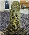
Old Wayside Cross - moved by Marlas Road, Pyle Parish
Groes Siencyn/Jenkins Cross, standing stone by the UC road, in parish of Pyle (Bridgend District), 65 Marlas Road, Pyle, in front garden, South side of road. To be surveyed Milestone Society National ID: BRI_PYL
Image: © Milestone Society Taken: Unknown
0.11 miles
4
Disused weir on the Afon Cynffig, Pyle
A structure identified as a disused weir on large scale Ordnance Survey mapping, although described as a dam in some sources. River water which accumulated at this spot was once diverted through a leat for purposes of powering the nearby Llanmihangel Mill.
Image: © eswales Taken: Unknown
0.12 miles
5
Inscribed Stone with Ordnance Survey Pivot
This 11th or 12th century slab with OS pivot can be found in the garden of No65 Marlas Road. It marks a point 39.011m above mean sea level.
Image: © Adrian Dust Taken: 10 Nov 2017
0.12 miles
6
Disused weir on the Afon Cynffig, Pyle (2)
A structure identified as a disused weir on large scale Ordnance Survey mapping, but as a dam in some other sources, and which once played a role in the diversion of river water to Llanmihangel Mill is seen here following substantial rainfall. Water flowing downstream may be seen to pass through here at three separate points. Much passes along a channel (at far left of picture) just beyond the western end of the main wall of the structure, although a considerable amount passes through two openings in the stonework – one in a side wall of the channel, the other in the main wall. By contrast in Image, taken a year earlier, it may be seen that water only passes along the channel, a consequence perhaps of the earlier photo having been taken at a time when there had been less recent rainfall and the river level was therefore lower.
Image: © eswales Taken: 6 Oct 2012
0.12 miles
7
Pyle : Shops
Shops including Fish'n' Chips, Pyle Charcoal Grill and Lotus House.
Image: © Lewis Clarke Taken: 13 Aug 2017
0.12 miles
8
Riverside trees, Pyle
A few days into October the leaves of some of the broadleaf trees surrounding the Afon Cynffig at Pyle are beginning to show some autumn colour. Below, some white water is formed on the river as it passes through the disused weir seen in Image The view is from the steep south side of a short valley which the river passes through here.
Image: © eswales Taken: 6 Oct 2012
0.12 miles
9
The Afon Cynffig, Pyle
A view looking downstream from beside the disused weir seen in Image The river is full and quite turbulent following recent rainfall, including a spell of persistent, sometimes heavy rain in the twenty four hours before the photograph was taken.
Image: © eswales Taken: 6 Oct 2012
0.12 miles
10
Dizzy's Play Centre on Pyle Road
Image: © David Howard Taken: 21 Jul 2024
0.12 miles
  • ...