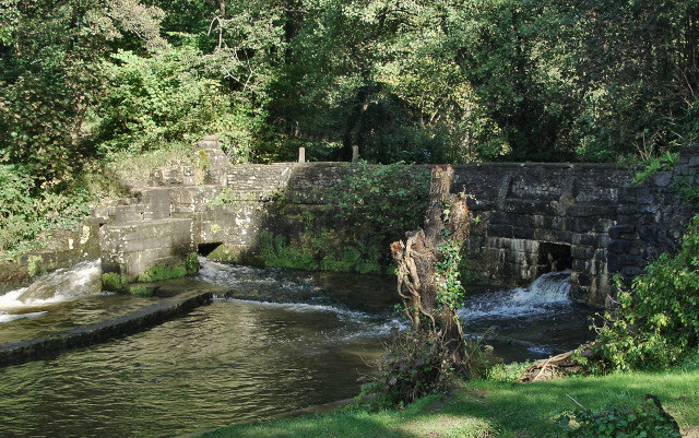
Disused weir on the Afon Cynffig, Pyle (2)
Introduction
The photograph on this page of Disused weir on the Afon Cynffig, Pyle (2) by eswales as part of the Geograph project.
The Geograph project started in 2005 with the aim of publishing, organising and preserving representative images for every square kilometre of Great Britain, Ireland and the Isle of Man.
There are currently over 7.5m images from over 14,400 individuals and you can help contribute to the project by visiting https://www.geograph.org.uk

Image: © eswales Taken: 6 Oct 2012
A structure identified as a disused weir on large scale Ordnance Survey mapping, but as a dam in some other sources, and which once played a role in the diversion of river water to Llanmihangel Mill is seen here following substantial rainfall. Water flowing downstream may be seen to pass through here at three separate points. Much passes along a channel (at far left of picture) just beyond the western end of the main wall of the structure, although a considerable amount passes through two openings in the stonework – one in a side wall of the channel, the other in the main wall. By contrast in Image, taken a year earlier, it may be seen that water only passes along the channel, a consequence perhaps of the earlier photo having been taken at a time when there had been less recent rainfall and the river level was therefore lower.

