IMAGES TAKEN NEAR TO
Pyle, BRIDGEND, CF33 4SA
Introduction
This page details the photographs taken nearby to CF33 4SA by members of the Geograph project.
The Geograph project started in 2005 with the aim of publishing, organising and preserving representative images for every square kilometre of Great Britain, Ireland and the Isle of Man.

There are currently over 7.5m images from over14,400 individuals and you can help contribute to the project by visiting https://www.geograph.org.uk
Image Map
Images are licensed for reuse under creativecommons.org/licenses/by-sa/2.0
Notes
- Clicking on the map will re-center to the selected point.
- The higher the marker number, the further away the image location is from the centre of the postcode.
Image Listing (9 Images Found)
Images are licensed for reuse under creativecommons.org/licenses/by-sa/2.0
Image
Details
Distance
1
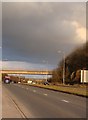
Bridge over the A4229, and stormy weather
Image: © Ruth Sharville
Taken: 19 Feb 2010
0.04 miles
3
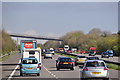
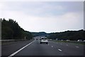
Bridgend District : The M4 Motorway
The M4 Motorway heading eastbound as it passes through the Bridgend area.
Image: © Lewis Clarke
Taken: 11 Apr 2014
0.20 miles
5
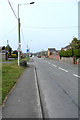
South Cornelly (north end)
Looking (roughly) north west along the northern half of the village's main thoroughfare, Porthcawl Road. The traffic on the road seems fairly light thanks to the existence of a by-pass to the west of the village.
Image: © eswales
Taken: 18 Apr 2008
0.22 miles
6
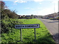
Cyrraedd De Corneli / Entering South Cornelly
Heol yn cyrraedd pentref De Corneli. Cyn y ffordd osgoi dyma oedd y brif heol i Borthcawl.
A road entering the village of South Cornelly. Prior to the by-pass this was the main road to Porthcawl (trans. sea-kale harbour).
Image: © Alan Richards
Taken: 3 Nov 2023
0.22 miles
7

Wooded footpath on the west side of the South Cornelly bypass (4)
The path continues the descent seen in Image At the bend seen in the current image, the path is close to the roundabout at the northern end of the South Cornelly bypass where the A4229 meets the B4283. After the bend, it runs close to the latter road for 80 metres or so before ending. At that point, you can continue walking northwards towards North Cornelly along a standard path/pavement at the edge of the road.
Image: © eswales
Taken: 1 Apr 2022
0.23 miles
8
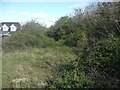
Course of former Porthcawl branch line at South Cornelly
Looking northwards towards Pyle at an unbuilt on, though overgrown, section of the route of the G.W.R. Porthcawl Branch line through South Cornelly. Prior to that line, the Dyffryn Llynfi & Porthcawl Railway ran along the same route here.
Image: © eswales
Taken: 1 Apr 2022
0.24 miles