1
Porthcawl Road
Image: © Colin Pyle
Taken: 29 Aug 2010
0.01 miles
2
Bungalows at the southern edge of North Cornelly
On the west side of the B4283 Porthcawl Road. A sign on the left points towards this http://www.geograph.org.uk/photo/5299070 public footpath.
Image: © Jaggery
Taken: 1 Mar 2017
0.01 miles
3
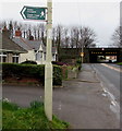
Bilingual public footpath sign in North Cornelly
At the edge of Porthcawl Road, the English/Welsh sign points towards this http://www.geograph.org.uk/photo/5299070 public footpath.
An M4 motorway bridge http://www.geograph.org.uk/photo/5298944 is in the background.
Image: © Jaggery
Taken: 1 Mar 2017
0.01 miles
4
Maesgwyn Therapies in North Cornelly
Maesgwyn osteopathy holistic & beauty therapies viewed across
the B4283 Porthcawl Road at the southern edge of North Cornelly.
Image: © Jaggery
Taken: 1 Mar 2017
0.02 miles
5
Ordnance Survey Cut Mark
This OS cut mark can be found on the gatepost of Maesgwyn, Porthcawl Road. It marks a point 27.606m above mean sea level.
Image: © Adrian Dust
Taken: 18 Aug 2021
0.02 miles
6
South side of the M4 motorway bridge, North Cornelly
The bridge carries the M4 motorway over the B4283 Porthcawl Road. Headroom shown is 3.6 metres / 12' 0".
Image: © Jaggery
Taken: 1 Mar 2017
0.02 miles
7
Southern boundary of North Cornelly
The B4283 Porthcawl Road reaches the boundary sign for the village of North Cornelly (Corneli in Welsh).
An M4 motorway bridge http://www.geograph.org.uk/photo/5298944 is in the background.
Image: © Jaggery
Taken: 1 Mar 2017
0.03 miles
8
Curwen Terrace Sewage Pumping Station, North Cornelly
Welsh Water asset number 53078 is set back from Porthcawl Road at the southern edge of North Cornelly.
Image: © Jaggery
Taken: 1 Mar 2017
0.03 miles
9
Ty Tanglwyst Farm access road, North Cornelly
From the east side of the B4283 Porthcawl Road, the private road
leads to the dairy farm and its self-catering holiday cottages.
Image: © Jaggery
Taken: 1 Mar 2017
0.03 miles
10
Public footpath at the southern edge of North Cornelly
From the west side of Porthcawl Road.
Image: © Jaggery
Taken: 1 Mar 2017
0.04 miles


