1
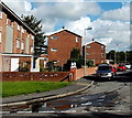
Heol-y-fferm, Tondu
Street on the east side of Heol-yr-ysgol.
Image: © Jaggery
Taken: 10 Oct 2014
0.03 miles
2
Ynysteg, Tondu
Cul-de-sac viewed across Heol-yr-ysgol
Image: © Jaggery
Taken: 10 Oct 2014
0.04 miles
3
Paul's Chippy, Tondu
The chip shop at 14 Heol-yr-ysgol in Ynysawdre, Tondu, is next door to a Premier store and off licence.
Image: © Jaggery
Taken: 10 Oct 2014
0.05 miles
4
Looking north along Heol Cwrdy, Ynysawdre, Sarn
Taken from a position close to the bridge over the Ogmore River. The road on the right in the foreground is Heol-Y-Bont.
Image: © Simon Mortimer
Taken: 8 Aug 2012
0.06 miles
5
Housing at Ynysawdre
A view towards housing on Heol-yr-Ysgol from National Cycle Route 4.
Image: © eswales
Taken: 16 Jan 2023
0.07 miles
6
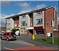
3-storey block of flats in Tondu
On the corner of Heol-y-bont and Heol-yr-ysgol, viewed from the edge of the Ogmore River.
Image: © Jaggery
Taken: 10 Oct 2014
0.08 miles
7
Heol-y-bont flats in Tondu
3-storey blocks of flats opposite the Ogmore River.
Image: © Jaggery
Taken: 10 Oct 2014
0.08 miles
8
Coleg Cymunedol Y Dderwen, Tondu
Coleg Cymunedol Y Dderwen was created in 2011, when Ynysawdre Comprehensive School officially closed and its former students merged with those of Ogmore School. The school operated on a split-site basis during the two-year transitional period. From the start of the 2013-2014 academic year in September 2013, the school has occupied new buildings in Heol-yr-ysgol, Ynysawdre, Tondu.
In view are buildings on the south side of the large site.
Image: © Jaggery
Taken: 10 Oct 2014
0.09 miles
9
National Cycle Route 4 at Ynysawdre
An area of woodland beside the River Ogmore lies to the right (east) of the cycle path here.
Image: © eswales
Taken: Unknown
0.09 miles
10
Entrance to a riverside path and cycleway, Tondu
From Heol-yr-ysgol. The route ahead, along a bank of the Ogmore River,
is a combined footpath and cycleway, part of National Cycle Network Route 4.
Image: © Jaggery
Taken: 10 Oct 2014
0.10 miles


