IMAGES TAKEN NEAR TO
Coytrahen, BRIDGEND, CF32 8YR

Introduction

This page details the photographs taken nearby to CF32 8YR by members of the Geograph project.

The Geograph project started in 2005 with the aim of publishing, organising and preserving representative images for every square kilometre of Great Britain, Ireland and the Isle of Man.

There are currently over 7.5m images from over14,400 individuals and you can help contribute to the project by visiting https://www.geograph.org.uk

Image Map


Images are licensed for reuse under creativecommons.org/licenses/by-sa/2.0
Notes
  • Clicking on the map will re-center to the selected point.
  • The higher the marker number, the further away the image location is from the centre of the postcode.

Image Listing (51 Images Found)

Images are licensed for reuse under creativecommons.org/licenses/by-sa/2.0
  • ...
Image
Details
Distance
1
Idyllic Location
This house enjoys an almost idyllic location alongside the Llynfi at Coytrahen. 'Almost' - note the railway bridge to the right!
Image: © Alan Hughes Taken: 3 Jan 2017
0.01 miles
2
Road bridge at Coytrahen
Road bridge at the point where the minor road which runs eastwards from Coytrahen crosses the Llynfi River.
Image: © eswales Taken: 14 Jun 2008
0.01 miles
3
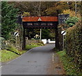
East side of a railway bridge, Coytrahen
A minor road passes under the bridge carrying the single-track Maesteg Line railway. The nameboards on the bridge show THIS BRIDGE IS COEDTREHEN Mileage 3m 45c E.L.R. - BAL This was the only location in Coytrahen where I saw the spelling Coedtrehen which looks like a Welsh language name for the village, perhaps the prevalent spelling in the 19th century when this bridge was installed.
Image: © Jaggery Taken: 28 Oct 2014
0.02 miles
4
West side of a railway bridge, Coytrahen
The single-track Maesteg Line crosses above a minor road. Headroom shown is 13' 0". The 30 mph speed limit in Coytrahen increases to the National Speed Limit ahead.
Image: © Jaggery Taken: 28 Oct 2014
0.02 miles
5
Ordnance Survey Cut Mark
This OS cut mark can be found on the north parapet of the bridge. It marks a point 54.529m above mean sea level.
Image: © Adrian Dust Taken: 13 Oct 2021
0.03 miles
6
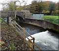
North side of a river bridge, Coytrahen
The River Llynfi flows under the bridge carrying a minor road. http://www.geograph.org.uk/photo/4224308 to a view of the south side of the bridge.
Image: © Jaggery Taken: 28 Oct 2014
0.03 miles
7
Weak bridge, Coytrahen
The sign shows a 10 tonnes weight limit on the stone bridge http://www.geograph.org.uk/photo/4224317 over the River Llynfi. Pont wan is Welsh for weak bridge. An Environment Agency river monitoring station is on the right.
Image: © Jaggery Taken: 28 Oct 2014
0.03 miles
8
White water in the Llynfi, Coytrahen
On the south side of the stone bridge carrying a minor road over the River Llynfi.
Image: © Jaggery Taken: 28 Oct 2014
0.03 miles
9
House and rail bridge at Coytrahen
Image: © John Finch Taken: 31 Oct 2011
0.03 miles
10
Llynfi Bridge
Bridge over the River Llynfi at Coytrahen.
Image: © Alan Hughes Taken: 3 Jan 2017
0.03 miles
  • ...