East side of a railway bridge, Coytrahen
Introduction
The photograph on this page of East side of a railway bridge, Coytrahen by Jaggery as part of the Geograph project.
The Geograph project started in 2005 with the aim of publishing, organising and preserving representative images for every square kilometre of Great Britain, Ireland and the Isle of Man.

There are currently over 7.5m images from over 14,400 individuals and you can help contribute to the project by visiting https://www.geograph.org.uk
East side of a railway bridge, Coytrahen
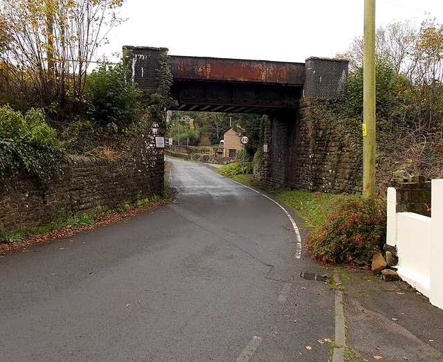
Image: © Jaggery Taken: 28 Oct 2014
A minor road passes under the bridge carrying the single-track Maesteg Line railway. The nameboards on the bridge show THIS BRIDGE IS COEDTREHEN Mileage 3m 45c E.L.R. - BAL This was the only location in Coytrahen where I saw the spelling Coedtrehen which looks like a Welsh language name for the village, perhaps the prevalent spelling in the 19th century when this bridge was installed.
Images are licensed for reuse under creativecommons.org/licenses/by-sa/2.0
Image Location
Latitude
51.557186
Longitude
-3.600365