
IMAGES TAKEN NEAR TO
Richard Street, BRIDGEND, CF32 8HU
Introduction
This page details the photographs taken nearby to Richard Street, CF32 8HU by members of the Geograph project.
The Geograph project started in 2005 with the aim of publishing, organising and preserving representative images for every square kilometre of Great Britain, Ireland and the Isle of Man.

There are currently over 7.5m images from over14,400 individuals and you can help contribute to the project by visiting https://www.geograph.org.uk
Image Map
Images are licensed for reuse under creativecommons.org/licenses/by-sa/2.0
Notes
- Clicking on the map will re-center to the selected point.
- The higher the marker number, the further away the image location is from the centre of the postcode.
Image Listing (107 Images Found)
Images are licensed for reuse under creativecommons.org/licenses/by-sa/2.0
Image
Details
Distance
1
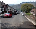
Down Richard Street, Pontycymer
Richard Street descends towards Oxford Street.
Image: © Jaggery
Taken: 6 Sep 2014
0.01 miles
2
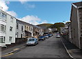
Ivor Street, Pontycymer
Looking east from Meadow Street.
Image: © Jaggery
Taken: 1 Sep 2014
0.02 miles
3
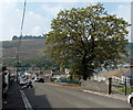
Early autumn colours in Pontycymer
In early September 2014, a few browns have appeared in the green foliage of a Richard Street tree.
Image: © Jaggery
Taken: 6 Sep 2014
0.02 miles
4
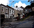
Houses at the top end of Ivor Street, Pontycymer
Viewed from near the corner of School Terrace, opposite Ffaldau Primary School. http://www.geograph.org.uk/photo/4150655
Image: © Jaggery
Taken: 1 Sep 2014
0.03 miles
5
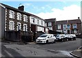
School Terrace, Pontycymer
Short street between Ivor Street and Ffaldau Primary School http://www.geograph.org.uk/photo/4150655 on this side, and Richard Street ahead.
Image: © Jaggery
Taken: 1 Sep 2014
0.03 miles
6
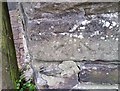
Ordnance Survey Cut Mark
This OS cut mark can be found on the wall of No17 Ivor Street. It marks a point 183.685m above mean sea level.
Image: © Adrian Dust
Taken: 29 May 2017
0.03 miles
7
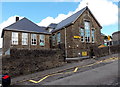
Ivor Street side of Ffaldau Primary School, Pontycymer
Extending for about 35 metres along Ivor Street, this is the narrower southern
edge of a rectangular school site extending north for 75 metres to Albany Road.
Image: © Jaggery
Taken: 1 Sep 2014
0.03 miles
8
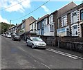
Up Richard Street, Pontycymer
Richard Street climbs steeply away from the corner of Church Street. Railings alongside the wall extend (with gaps for access to houses) to the top of the hill - useful to hang on to when the pavement is icy!
Image: © Jaggery
Taken: 1 Sep 2014
0.04 miles
9
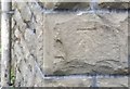
Ordnance Survey Cut Mark
This OS cut mark can be found on the SW angle of the school. It marks a point 181.225m above mean sea level.
Image: © Adrian Dust
Taken: 29 May 2017
0.04 miles
10

View from Werfa along the Garw Valley
Pontycymer in the distance.
Image: © Alan Hughes
Taken: 24 Jul 2025
0.06 miles